
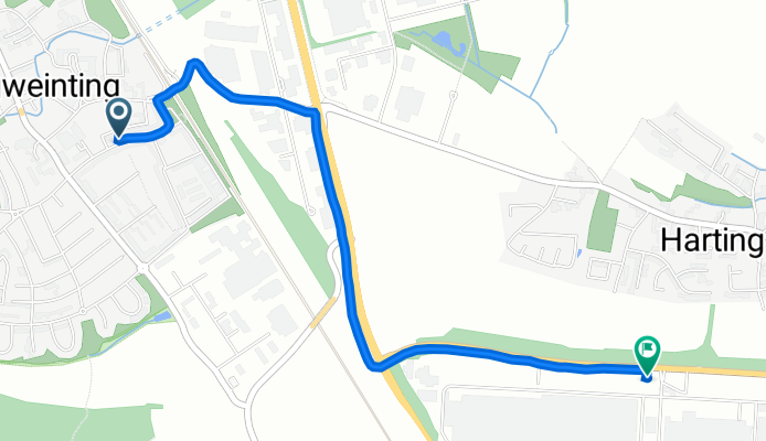
Friedrich-Viehbacher-Allee 24, Regensburg nach Herbert-Quandt-Allee 1a, Regensburg
A cycling route starting in Obertraubling, Bavaria, Germany.
Overview
About this route
- 8 min
- Duration
- 2.9 km
- Distance
- 0 m
- Ascent
- 56 m
- Descent
- 21.3 km/h
- Avg. speed
- 385 m
- Max. altitude

Route quality
Waytypes & surfaces along the route
Waytypes
Path
1.5 km
(52 %)
Quiet road
1.1 km
(38 %)
Surfaces
Paved
2.5 km
(87 %)
Asphalt
2.5 km
(86 %)
Paving stones
0 km
(<1 %)
Undefined
0.4 km
(13 %)
Continue with Bikemap
Use, edit, or download this cycling route
You would like to ride Friedrich-Viehbacher-Allee 24, Regensburg nach Herbert-Quandt-Allee 1a, Regensburg or customize it for your own trip? Here is what you can do with this Bikemap route:
Free features
- Save this route as favorite or in collections
- Copy & plan your own version of this route
- Sync your route with Garmin or Wahoo
Premium features
Free trial for 3 days, or one-time payment. More about Bikemap Premium.
- Navigate this route on iOS & Android
- Export a GPX / KML file of this route
- Create your custom printout (try it for free)
- Download this route for offline navigation
Discover more Premium features.
Get Bikemap PremiumFrom our community
Other popular routes starting in Obertraubling
 Piesenkofen Richtung Thalmassing
- Distance
- 19.5 km
- Ascent
- 124 m
- Descent
- 122 m
- Location
- Obertraubling, Bavaria, Germany
 Bad Abbach,Dom
- Distance
- 41.5 km
- Ascent
- 286 m
- Descent
- 286 m
- Location
- Obertraubling, Bavaria, Germany
 Quick bike tour through Obertraubling
- Distance
- 7.5 km
- Ascent
- 83 m
- Descent
- 78 m
- Location
- Obertraubling, Bavaria, Germany
 Regenpanoramatour
- Distance
- 92.6 km
- Ascent
- 699 m
- Descent
- 700 m
- Location
- Obertraubling, Bavaria, Germany
 Biergarten Huf u. Adlersberg
- Distance
- 18.2 km
- Ascent
- 205 m
- Descent
- 151 m
- Location
- Obertraubling, Bavaria, Germany
 Obertraubling-Matting und zurück
- Distance
- 32.5 km
- Ascent
- 249 m
- Descent
- 242 m
- Location
- Obertraubling, Bavaria, Germany
 Huf,Adlersberg,Pentling
- Distance
- 56.3 km
- Ascent
- 541 m
- Descent
- 543 m
- Location
- Obertraubling, Bavaria, Germany
 Regenpanoramatour
- Distance
- 92.6 km
- Ascent
- 714 m
- Descent
- 711 m
- Location
- Obertraubling, Bavaria, Germany
Open it in the app