De Hiesse à Niort
- 107.5 km
- 554 m
- 724 m
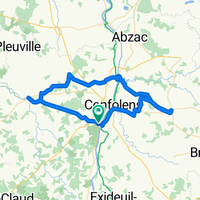
- Confolens, Nouvelle-Aquitaine, France
A cycling route starting in Confolens, Nouvelle-Aquitaine, France.
Overview
created this 2 years ago
Route quality
Road
21.9 km
(70 %)
Quiet road
6 km
(19 %)
Undefined
3.4 km
(11 %)
Paved
19.7 km
(63 %)
Asphalt
19.7 km
(63 %)
Undefined
11.6 km
(37 %)
Continue with Bikemap
You would like to ride De Confolens à D160, Pressignac or customize it for your own trip? Here is what you can do with this Bikemap route:
Free trial for 3 days, or one-time payment. More about Bikemap Premium.
Discover more Premium features.
Get Bikemap PremiumFrom our community
Open it in the app