

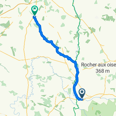
De D160, Pressignac à Le Chambon 599, Eymouthiers
A cycling route starting in Chabanais, Nouvelle-Aquitaine, France.
Overview
About this route
- 1 h 50 min
- Duration
- 28.2 km
- Distance
- 312 m
- Ascent
- 397 m
- Descent
- 15.4 km/h
- Avg. speed
- 289 m
- Max. altitude

Route quality
Waytypes & surfaces along the route
Waytypes
Road
21.7 km
(77 %)
Quiet road
3.4 km
(12 %)
Surfaces
Paved
2.5 km
(9 %)
Asphalt
2.5 km
(9 %)
Undefined
25.7 km
(91 %)
Continue with Bikemap
Use, edit, or download this cycling route
You would like to ride De D160, Pressignac à Le Chambon 599, Eymouthiers or customize it for your own trip? Here is what you can do with this Bikemap route:
Free features
- Save this route as favorite or in collections
- Copy & plan your own version of this route
- Sync your route with Garmin or Wahoo
Premium features
Free trial for 3 days, or one-time payment. More about Bikemap Premium.
- Navigate this route on iOS & Android
- Export a GPX / KML file of this route
- Create your custom printout (try it for free)
- Download this route for offline navigation
Discover more Premium features.
Get Bikemap PremiumFrom our community
Other popular routes starting in Chabanais
 Pressignac - St Pardoux la Rivière
- Distance
- 67.5 km
- Ascent
- 934 m
- Descent
- 1,014 m
- Location
- Chabanais, Nouvelle-Aquitaine, France
 D214, Saint-Quentin-sur-Charente nach D52 4, Lésignac-Durand
- Distance
- 6.4 km
- Ascent
- 141 m
- Descent
- 125 m
- Location
- Chabanais, Nouvelle-Aquitaine, France
 2020_E14_Chabanais_Vivonne
- Distance
- 89.2 km
- Ascent
- 806 m
- Descent
- 873 m
- Location
- Chabanais, Nouvelle-Aquitaine, France
 De 3B Rue Maurice Faurisson, Chabanais à 4 Avenue Jean Augry, L'Isle-Jourdain
- Distance
- 51.1 km
- Ascent
- 579 m
- Descent
- 592 m
- Location
- Chabanais, Nouvelle-Aquitaine, France
 Pressignac/Villars
- Distance
- 57.9 km
- Ascent
- 622 m
- Descent
- 718 m
- Location
- Chabanais, Nouvelle-Aquitaine, France
 Chabanais - Montbrond (41 km) - Angoulème (41 km)
- Distance
- 81.4 km
- Ascent
- 850 m
- Descent
- 958 m
- Location
- Chabanais, Nouvelle-Aquitaine, France
 De La Chassagne 15-9, Videix à Coudert du Merle, Eymouthiers
- Distance
- 30.1 km
- Ascent
- 342 m
- Descent
- 473 m
- Location
- Chabanais, Nouvelle-Aquitaine, France
 Pressignac - Châlus (Mialet)
- Distance
- 41.9 km
- Ascent
- 412 m
- Descent
- 320 m
- Location
- Chabanais, Nouvelle-Aquitaine, France
Open it in the app