

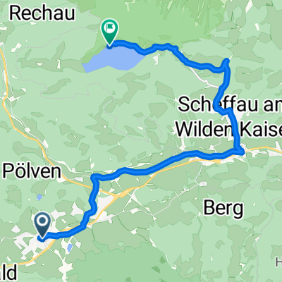
Bromberg 8, Söll nach Lanzenweg 4, Going am Wilden Kaiser
A cycling route starting in Söll, Tyrol, Austria.
Overview
About this route
- 1 h 39 min
- Duration
- 17.4 km
- Distance
- 405 m
- Ascent
- 565 m
- Descent
- 10.5 km/h
- Avg. speed
- 933 m
- Max. altitude

Continue with Bikemap
Use, edit, or download this cycling route
You would like to ride Bromberg 8, Söll nach Lanzenweg 4, Going am Wilden Kaiser or customize it for your own trip? Here is what you can do with this Bikemap route:
Free features
- Save this route as favorite or in collections
- Copy & plan your own version of this route
- Sync your route with Garmin or Wahoo
Premium features
Free trial for 3 days, or one-time payment. More about Bikemap Premium.
- Navigate this route on iOS & Android
- Export a GPX / KML file of this route
- Create your custom printout (try it for free)
- Download this route for offline navigation
Discover more Premium features.
Get Bikemap PremiumFrom our community
Other popular routes starting in Söll
 Zum Hintersteiner See
- Distance
- 12.1 km
- Ascent
- 332 m
- Descent
- 133 m
- Location
- Söll, Tyrol, Austria
 Hohe Salve
- Distance
- 9.6 km
- Ascent
- 1,116 m
- Descent
- 37 m
- Location
- Söll, Tyrol, Austria
 Part of Soll - Hexenwasser
- Distance
- 2.5 km
- Ascent
- 377 m
- Descent
- 50 m
- Location
- Söll, Tyrol, Austria
 Dorf to Unterwindau
- Distance
- 15.7 km
- Ascent
- 376 m
- Descent
- 377 m
- Location
- Söll, Tyrol, Austria
 Söll - Rübezahlalm
- Distance
- 13.2 km
- Ascent
- 567 m
- Descent
- 92 m
- Location
- Söll, Tyrol, Austria
 Wilder Kaiser Tour 2 - 58,9KM
- Distance
- 58.9 km
- Ascent
- 479 m
- Descent
- 480 m
- Location
- Söll, Tyrol, Austria
 Söll Bergdoktor Haus
- Distance
- 5.5 km
- Ascent
- 405 m
- Descent
- 93 m
- Location
- Söll, Tyrol, Austria
 Söll - Hartkaiser - Brandstadl - Hochsöll - Söll
- Distance
- 33.4 km
- Ascent
- 1,026 m
- Descent
- 1,026 m
- Location
- Söll, Tyrol, Austria
Open it in the app