

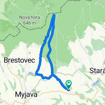
Mizerákovci, Stará Myjava do Petrova Ves
A cycling route starting in Myjava, Trenčín Region, Slovakia.
Overview
About this route
- 9 h 36 min
- Duration
- 65.9 km
- Distance
- 1,276 m
- Ascent
- 1,665 m
- Descent
- 6.9 km/h
- Avg. speed
- 583 m
- Max. altitude

Route photos


Route quality
Waytypes & surfaces along the route
Waytypes
Road
20.4 km
(31 %)
Track
18.5 km
(28 %)
Surfaces
Paved
34.3 km
(52 %)
Unpaved
15.2 km
(23 %)
Asphalt
33.6 km
(51 %)
Ground
9.9 km
(15 %)
Continue with Bikemap
Use, edit, or download this cycling route
You would like to ride Mizerákovci, Stará Myjava do Petrova Ves or customize it for your own trip? Here is what you can do with this Bikemap route:
Free features
- Save this route as favorite or in collections
- Copy & plan your own version of this route
- Sync your route with Garmin or Wahoo
Premium features
Free trial for 3 days, or one-time payment. More about Bikemap Premium.
- Navigate this route on iOS & Android
- Export a GPX / KML file of this route
- Create your custom printout (try it for free)
- Download this route for offline navigation
Discover more Premium features.
Get Bikemap PremiumFrom our community
Other popular routes starting in Myjava
 Vrbovce do Vrbovce
- Distance
- 18.9 km
- Ascent
- 254 m
- Descent
- 297 m
- Location
- Myjava, Trenčín Region, Slovakia
 Nepretržitá jazda
- Distance
- 16.7 km
- Ascent
- 359 m
- Descent
- 427 m
- Location
- Myjava, Trenčín Region, Slovakia
 Rudník do Rudník
- Distance
- 23.6 km
- Ascent
- 325 m
- Descent
- 370 m
- Location
- Myjava, Trenčín Region, Slovakia
 Rudník do Rudník
- Distance
- 19 km
- Ascent
- 276 m
- Descent
- 273 m
- Location
- Myjava, Trenčín Region, Slovakia
 Trasa do Rudník
- Distance
- 11.5 km
- Ascent
- 155 m
- Descent
- 143 m
- Location
- Myjava, Trenčín Region, Slovakia
 Krásne kopanice
- Distance
- 45.9 km
- Ascent
- 473 m
- Descent
- 479 m
- Location
- Myjava, Trenčín Region, Slovakia
 Myjava_Senica_Jablonica_Brezova_Myjava
- Distance
- 55.2 km
- Ascent
- 425 m
- Descent
- 406 m
- Location
- Myjava, Trenčín Region, Slovakia
 k ivanovy home
- Distance
- 96 km
- Ascent
- 283 m
- Descent
- 507 m
- Location
- Myjava, Trenčín Region, Slovakia
Open it in the app