
VT #4
A cycling route starting in Monor, Bistrița-Năsăud County, Romania.
Overview
About this route
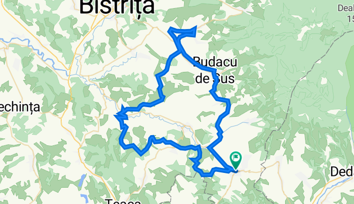
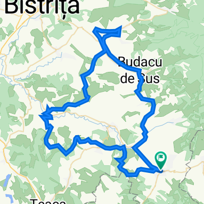
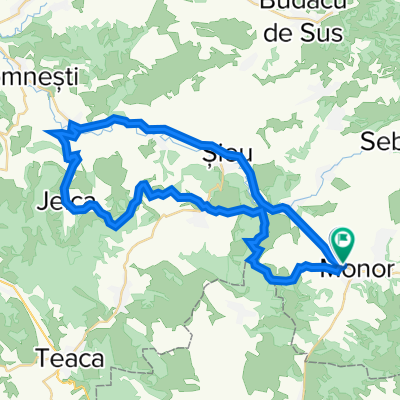
Monor - Posmuș - Jeica - Mărișelu - Petriș - Monor
Obiective: Cetate (Posmuș), sat Monor, sat Petriș
- -:--
- Duration
- 77.5 km
- Distance
- 1,344 m
- Ascent
- 1,343 m
- Descent
- ---
- Avg. speed
- 708 m
- Max. altitude

Route quality
Waytypes & surfaces along the route
Waytypes
Track
24 km
(31 %)
Road
22.5 km
(29 %)
Surfaces
Paved
27.1 km
(35 %)
Unpaved
32.5 km
(42 %)
Asphalt
27.1 km
(35 %)
Ground
18.6 km
(24 %)
Continue with Bikemap
Use, edit, or download this cycling route
You would like to ride VT #4 or customize it for your own trip? Here is what you can do with this Bikemap route:
Free features
- Save this route as favorite or in collections
- Copy & plan your own version of this route
- Sync your route with Garmin or Wahoo
Premium features
Free trial for 3 days, or one-time payment. More about Bikemap Premium.
- Navigate this route on iOS & Android
- Export a GPX / KML file of this route
- Create your custom printout (try it for free)
- Download this route for offline navigation
Discover more Premium features.
Get Bikemap PremiumFrom our community
Other popular routes starting in Monor
 Drumul Monorului, Monor to Drumul Glediunului, Monor
- Distance
- 20.4 km
- Ascent
- 389 m
- Descent
- 389 m
- Location
- Monor, Bistrița-Năsăud County, Romania
 VT #4
VT #4- Distance
- 77.5 km
- Ascent
- 1,344 m
- Descent
- 1,343 m
- Location
- Monor, Bistrița-Năsăud County, Romania
 VT - Ziua 7 - Gledin - Brancovenesti - Casva - Bradatelu
- Distance
- 60.8 km
- Ascent
- 1,546 m
- Descent
- 1,430 m
- Location
- Monor, Bistrița-Năsăud County, Romania
 SZT.2N - Régen - VT.: Sajónagyfalú - Paszmos
- Distance
- 45 km
- Ascent
- 777 m
- Descent
- 782 m
- Location
- Monor, Bistrița-Năsăud County, Romania
Open it in the app