München - Kufstein
A cycling route starting in Schliersee, Bavaria, Germany.
Overview
About this route
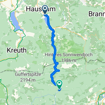
24.6.2024. 1. etappe
-
Hente sykler hos Radius Bikes, München, kl 0900.
-
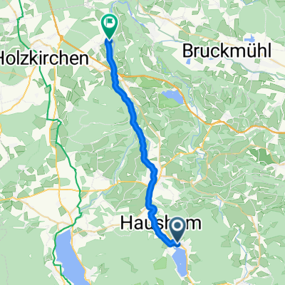
Tog Munchen - Schliersee, kl. 09.26 - 10.24.
-
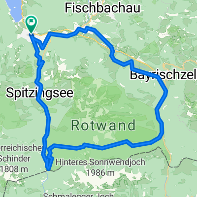
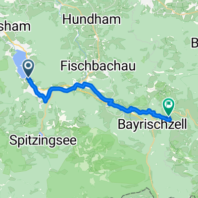
Sykkel Schliersee - Kufstein
Hotel Andreas Hofer, Kufstein
- 4 h 27 min
- Duration
- 70.3 km
- Distance
- 482 m
- Ascent
- 772 m
- Descent
- 15.8 km/h
- Avg. speed
- 824 m
- Max. altitude
Route photos
Route quality
Waytypes & surfaces along the route
Waytypes
Quiet road
36.5 km
(52 %)
Track
26.7 km
(38 %)
Surfaces
Paved
54.1 km
(77 %)
Unpaved
12.7 km
(18 %)
Asphalt
52.7 km
(75 %)
Loose gravel
6.3 km
(9 %)
Route highlights
Points of interest along the route

Bike service after 1.1 km
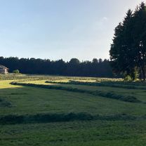
Her henter vi syklene.
Continue with Bikemap
Use, edit, or download this cycling route
You would like to ride München - Kufstein or customize it for your own trip? Here is what you can do with this Bikemap route:
Free features
- Save this route as favorite or in collections
- Copy & plan your own version of this route
- Sync your route with Garmin or Wahoo
Premium features
Free trial for 3 days, or one-time payment. More about Bikemap Premium.
- Navigate this route on iOS & Android
- Export a GPX / KML file of this route
- Create your custom printout (try it for free)
- Download this route for offline navigation
Discover more Premium features.
Get Bikemap PremiumFrom our community
Other popular routes starting in Schliersee
Triathlonstrecke Hexal Alpentriathlon- Distance
- 40 km
- Ascent
- 817 m
- Descent
- 491 m
- Location
- Schliersee, Bavaria, Germany
Schliersee über Valepp zum Tegernsee und zurück- Distance
- 28.6 km
- Ascent
- 591 m
- Descent
- 641 m
- Location
- Schliersee, Bavaria, Germany
Hexal Alpen-Triathlon Radstrecke- Distance
- 39.4 km
- Ascent
- 734 m
- Descent
- 526 m
- Location
- Schliersee, Bavaria, Germany
Schliersee Tegernsee Rundfahrt- Distance
- 54.2 km
- Ascent
- 364 m
- Descent
- 364 m
- Location
- Schliersee, Bavaria, Germany
Dreiseenrunde Schliersee-Tegernsee-Spitzingsee- Distance
- 52.3 km
- Ascent
- 771 m
- Descent
- 765 m
- Location
- Schliersee, Bavaria, Germany
Valepprunde- Distance
- 44.9 km
- Ascent
- 1,034 m
- Descent
- 1,031 m
- Location
- Schliersee, Bavaria, Germany
Gindelalm- Distance
- 34.3 km
- Ascent
- 1,139 m
- Descent
- 1,139 m
- Location
- Schliersee, Bavaria, Germany
Schliersee - Tegernsee- Distance
- 23.2 km
- Ascent
- 925 m
- Descent
- 925 m
- Location
- Schliersee, Bavaria, Germany
Open it in the app


