

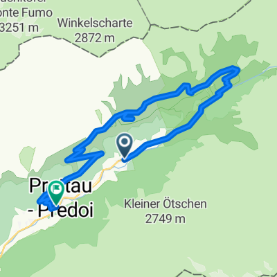
Casere - Rif.Tridentina - Rif.Vetta d'Italia
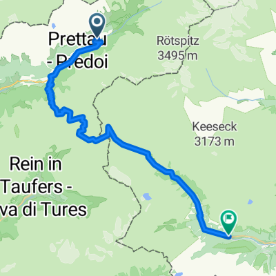
A cycling route starting in Prettau, Trentino-Alto Adige, Italy.
Overview
About this route
Rif.Tridentina 8 km +820 m --> Rif.Vetta Italia 13 km +1000 m total. Between Rif. V. Italia and Tridentina there are exposed equipped sections.
- -:--
- Duration
- 19.9 km
- Distance
- 1,123 m
- Ascent
- 1,124 m
- Descent
- ---
- Avg. speed
- 2,559 m
- Max. altitude
Route quality
Waytypes & surfaces along the route
Waytypes
Path
12.4 km
(62 %)
Quiet road
4.4 km
(22 %)
Track
3.2 km
(16 %)
Surfaces
Paved
1.8 km
(9 %)
Unpaved
11.8 km
(59 %)
Gravel
5.8 km
(29 %)
Rock
5.4 km
(27 %)
Route highlights
Points of interest along the route
Point of interest after 11.2 km
in questo punto qualche tratto esposto attrezzato
Point of interest after 12.7 km
RIFUGIO VETTA D'ITALIA
Point of interest after 15.5 km
TAUERNALM si mangia bene (no pasta)
Continue with Bikemap
Use, edit, or download this cycling route
You would like to ride Casere - Rif.Tridentina - Rif.Vetta d'Italia or customize it for your own trip? Here is what you can do with this Bikemap route:
Free features
- Save this route as favorite or in collections
- Copy & plan your own version of this route
- Sync your route with Garmin or Wahoo
Premium features
Free trial for 3 days, or one-time payment. More about Bikemap Premium.
- Navigate this route on iOS & Android
- Export a GPX / KML file of this route
- Create your custom printout (try it for free)
- Download this route for offline navigation
Discover more Premium features.
Get Bikemap PremiumFrom our community
Other popular routes starting in Prettau
 Prettau -Plätzwiese
- Distance
- 86.5 km
- Ascent
- 2,397 m
- Descent
- 1,862 m
- Location
- Prettau, Trentino-Alto Adige, Italy
 Casere - Rif.Tridentina - Rif.Vetta d'Italia
- Distance
- 19.9 km
- Ascent
- 1,123 m
- Descent
- 1,124 m
- Location
- Prettau, Trentino-Alto Adige, Italy
 2015 Prettau-Waldner-Tauernalm (13.08.2015)
- Distance
- 22 km
- Ascent
- 807 m
- Descent
- 810 m
- Location
- Prettau, Trentino-Alto Adige, Italy
 Anello: Predoi - FuchsAlm - TauernAlm - Casere
- Distance
- 15.2 km
- Ascent
- 749 m
- Descent
- 880 m
- Location
- Prettau, Trentino-Alto Adige, Italy
 Malga Alprechalm
- Distance
- 5.2 km
- Ascent
- 569 m
- Descent
- 20 m
- Location
- Prettau, Trentino-Alto Adige, Italy
 Casere - TauernAlm - Rif.Vetta d'Italia
- Distance
- 15.3 km
- Ascent
- 968 m
- Descent
- 966 m
- Location
- Prettau, Trentino-Alto Adige, Italy
 Von Prettau bis Sankt Jakob in Defereggen
- Distance
- 37 km
- Ascent
- 1,995 m
- Descent
- 2,042 m
- Location
- Prettau, Trentino-Alto Adige, Italy
 S. Pietro - Molini di Tures
- Distance
- 23.3 km
- Ascent
- 292 m
- Descent
- 683 m
- Location
- Prettau, Trentino-Alto Adige, Italy
Open it in the app