

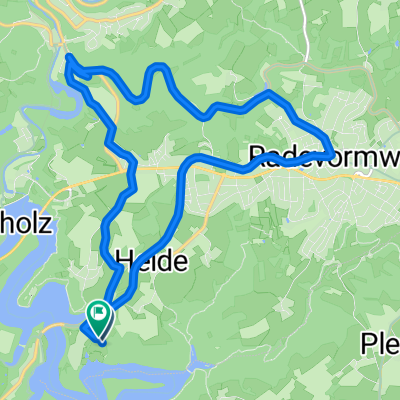
Funkenhausen 4, Radevormwald nach Funkenhausen 4, Radevormwald
A cycling route starting in Radevormwald, North Rhine-Westphalia, Germany.
Overview
About this route
- 1 h 19 min
- Duration
- 24.2 km
- Distance
- 279 m
- Ascent
- 305 m
- Descent
- 18.4 km/h
- Avg. speed
- 411 m
- Max. altitude
Route quality
Waytypes & surfaces along the route
Waytypes
Path
8.2 km
(34 %)
Track
6 km
(25 %)
Surfaces
Paved
18.8 km
(78 %)
Unpaved
3.4 km
(14 %)
Asphalt
18.1 km
(75 %)
Pebblestone
1.4 km
(6 %)
Continue with Bikemap
Use, edit, or download this cycling route
You would like to ride Funkenhausen 4, Radevormwald nach Funkenhausen 4, Radevormwald or customize it for your own trip? Here is what you can do with this Bikemap route:
Free features
- Save this route as favorite or in collections
- Copy & plan your own version of this route
- Sync your route with Garmin or Wahoo
Premium features
Free trial for 3 days, or one-time payment. More about Bikemap Premium.
- Navigate this route on iOS & Android
- Export a GPX / KML file of this route
- Create your custom printout (try it for free)
- Download this route for offline navigation
Discover more Premium features.
Get Bikemap PremiumFrom our community
Other popular routes starting in Radevormwald
 Radevormwald-Königsfeld-Spreelerweg-Beyenburg-Radevormwald
- Distance
- 40.1 km
- Ascent
- 385 m
- Descent
- 386 m
- Location
- Radevormwald, North Rhine-Westphalia, Germany
 Tannenbergweg 3, Radevormwald nach Tannenbergweg 3, Radevormwald
- Distance
- 4.2 km
- Ascent
- 4 m
- Descent
- 23 m
- Location
- Radevormwald, North Rhine-Westphalia, Germany
 Route von Kräwinkel II, Radevormwald
- Distance
- 14.2 km
- Ascent
- 269 m
- Descent
- 266 m
- Location
- Radevormwald, North Rhine-Westphalia, Germany
 Von Remscheid bis Wipperfürth
- Distance
- 13.5 km
- Ascent
- 206 m
- Descent
- 166 m
- Location
- Radevormwald, North Rhine-Westphalia, Germany
 Bever-, Wupper-, Panzertalsperre
- Distance
- 34.5 km
- Ascent
- 480 m
- Descent
- 554 m
- Location
- Radevormwald, North Rhine-Westphalia, Germany
 Adler RTF 41er bis 2008
- Distance
- 36 km
- Ascent
- 376 m
- Descent
- 395 m
- Location
- Radevormwald, North Rhine-Westphalia, Germany
 Radevormwald-Ennepetalsperre-Halver
- Distance
- 31.6 km
- Ascent
- 328 m
- Descent
- 328 m
- Location
- Radevormwald, North Rhine-Westphalia, Germany
 Radevormwald - Wuppertal
- Distance
- 25.4 km
- Ascent
- 519 m
- Descent
- 478 m
- Location
- Radevormwald, North Rhine-Westphalia, Germany
Open it in the app