

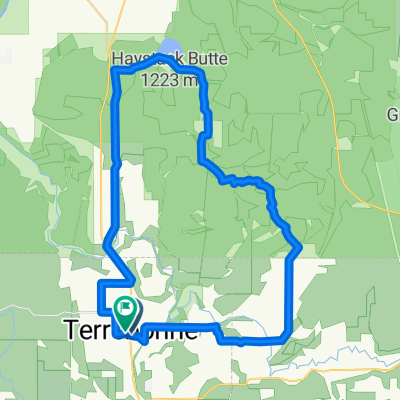
10087 NE Crooked River Dr, Terrebonne to 448 NW 24th Pl, Redmond
A cycling route starting in Terrebonne, Oregon, United States.
Overview
About this route
- 1 h
- Duration
- 19.2 km
- Distance
- 142 m
- Ascent
- 99 m
- Descent
- 19.3 km/h
- Avg. speed
- 919 m
- Max. altitude
Route quality
Waytypes & surfaces along the route
Waytypes
Quiet road
10 km
(52 %)
Road
4.8 km
(25 %)
Surfaces
Paved
7.7 km
(40 %)
Asphalt
7.7 km
(40 %)
Undefined
11.5 km
(60 %)
Continue with Bikemap
Use, edit, or download this cycling route
You would like to ride 10087 NE Crooked River Dr, Terrebonne to 448 NW 24th Pl, Redmond or customize it for your own trip? Here is what you can do with this Bikemap route:
Free features
- Save this route as favorite or in collections
- Copy & plan your own version of this route
- Sync your route with Garmin or Wahoo
Premium features
Free trial for 3 days, or one-time payment. More about Bikemap Premium.
- Navigate this route on iOS & Android
- Export a GPX / KML file of this route
- Create your custom printout (try it for free)
- Download this route for offline navigation
Discover more Premium features.
Get Bikemap PremiumFrom our community
Other popular routes starting in Terrebonne
 SmithRock BanditSprings
- Distance
- 77.6 km
- Ascent
- 611 m
- Descent
- 91 m
- Location
- Terrebonne, Oregon, United States
 10087 NE Crooked River Dr, Terrebonne to 448 NW 24th Pl, Redmond
- Distance
- 19.2 km
- Ascent
- 142 m
- Descent
- 99 m
- Location
- Terrebonne, Oregon, United States
 Northeast 29th Street 4288, Redmond to Northeast 33rd Street 4750, Redmond
- Distance
- 18.6 km
- Ascent
- 145 m
- Descent
- 148 m
- Location
- Terrebonne, Oregon, United States
 Terrebone, Haystack, Smith Rock
- Distance
- 53.8 km
- Ascent
- 748 m
- Descent
- 747 m
- Location
- Terrebonne, Oregon, United States
 r226 ROAM
- Distance
- 116.1 km
- Ascent
- 669 m
- Descent
- 965 m
- Location
- Terrebonne, Oregon, United States
 Terrebonne Cycling
- Distance
- 31.7 km
- Ascent
- 232 m
- Descent
- 231 m
- Location
- Terrebonne, Oregon, United States
 Terrebonne Cycling
- Distance
- 21.7 km
- Ascent
- 164 m
- Descent
- 153 m
- Location
- Terrebonne, Oregon, United States
 7th Street pub to Smith Rock State Park
- Distance
- 18.8 km
- Ascent
- 114 m
- Descent
- 64 m
- Location
- Terrebonne, Oregon, United States
Open it in the app