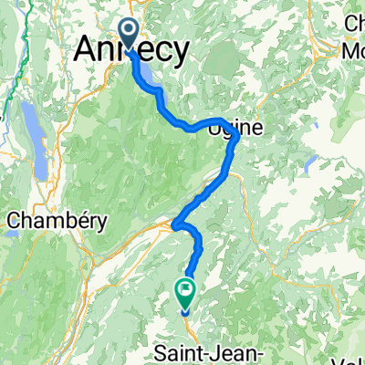
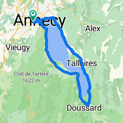
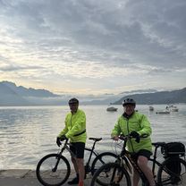
Lake Annecy loop with 3 Climbs
A cycling route starting in Annecy, Auvergne-Rhône-Alpes, France.
Overview
About this route
Great loop around Lake Annecy via Col de Tamié, Col de l'Epine, and the STEEP Col de la Forclaz de Montmin.
Details Snow capped peaks everywhere - -:--
- Duration
- 101.9 km
- Distance
- 2,041 m
- Ascent
- 2,020 m
- Descent
- ---
- Avg. speed
- 1,128 m
- Avg. speed
Route quality
Waytypes & surfaces along the route
Waytypes
Busy road
35.7 km
(35 %)
Road
28.5 km
(28 %)
Surfaces
Paved
76 km
(75 %)
Unpaved
0.4 km
(<1 %)
Asphalt
75.9 km
(74 %)
Gravel
0.4 km
(<1 %)
Route highlights
Points of interest along the route
Point of interest after 32.8 km
Col du Tamié
Continue with Bikemap
Use, edit, or download this cycling route
You would like to ride Lake Annecy loop with 3 Climbs or customize it for your own trip? Here is what you can do with this Bikemap route:
Free features
- Save this route as favorite or in collections
- Copy & plan your own version of this route
- Split it into stages to create a multi-day tour
- Sync your route with Garmin or Wahoo
Premium features
Free trial for 3 days, or one-time payment. More about Bikemap Premium.
- Navigate this route on iOS & Android
- Export a GPX / KML file of this route
- Create your custom printout (try it for free)
- Download this route for offline navigation
Discover more Premium features.
Get Bikemap PremiumFrom our community
Other popular routes starting in Annecy
- J3 – Arpettaz - Aravis
- Distance
- 124.9 km
- Ascent
- 3,042 m
- Descent
- 3,041 m
- Location
- Annecy, Auvergne-Rhône-Alpes, France
- Lake Annecy via Col de la Forclaz
- Distance
- 51.9 km
- Ascent
- 778 m
- Descent
- 779 m
- Location
- Annecy, Auvergne-Rhône-Alpes, France
- Annecy lac et Semnoz
- Distance
- 73 km
- Ascent
- 1,463 m
- Descent
- 1,462 m
- Location
- Annecy, Auvergne-Rhône-Alpes, France
- 02 Annecy-Moûtiers
- Distance
- 70.8 km
- Ascent
- 294 m
- Descent
- 268 m
- Location
- Annecy, Auvergne-Rhône-Alpes, France
- J1 V2 – Lac et Semnoz
- Distance
- 55 km
- Ascent
- 1,488 m
- Descent
- 1,488 m
- Location
- Annecy, Auvergne-Rhône-Alpes, France
- 4.11 Annecy to Lyon
- Distance
- 164.8 km
- Ascent
- 1,111 m
- Descent
- 1,385 m
- Location
- Annecy, Auvergne-Rhône-Alpes, France
- Col de la Madeleine
- Distance
- 121.5 km
- Ascent
- 1,903 m
- Descent
- 1,818 m
- Location
- Annecy, Auvergne-Rhône-Alpes, France
- FORCLAZ MONTMIN VERSANT SUD 31MAI 2014
- Distance
- 54.5 km
- Ascent
- 757 m
- Descent
- 759 m
- Location
- Annecy, Auvergne-Rhône-Alpes, France
Open it in the app