
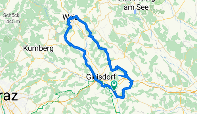
Weiz - Raabklamm, Wolga, Prebuch, Obergrossau, wetzawinkel ( 56 km )
A cycling route starting in Hofstätten an der Raab, Styria, Austria.
Overview
About this route
- -:--
- Duration
- 55.9 km
- Distance
- 842 m
- Ascent
- 848 m
- Descent
- ---
- Avg. speed
- 526 m
- Max. altitude

Route quality
Waytypes & surfaces along the route
Waytypes
Quiet road
31.9 km
(57 %)
Road
11.2 km
(20 %)
Surfaces
Paved
39.7 km
(71 %)
Unpaved
5 km
(9 %)
Asphalt
36.9 km
(66 %)
Paved (undefined)
2.8 km
(5 %)
Continue with Bikemap
Use, edit, or download this cycling route
You would like to ride Weiz - Raabklamm, Wolga, Prebuch, Obergrossau, wetzawinkel ( 56 km ) or customize it for your own trip? Here is what you can do with this Bikemap route:
Free features
- Save this route as favorite or in collections
- Copy & plan your own version of this route
- Sync your route with Garmin or Wahoo
Premium features
Free trial for 3 days, or one-time payment. More about Bikemap Premium.
- Navigate this route on iOS & Android
- Export a GPX / KML file of this route
- Create your custom printout (try it for free)
- Download this route for offline navigation
Discover more Premium features.
Get Bikemap PremiumFrom our community
Other popular routes starting in Hofstätten an der Raab
 Gnasrunde ( 68 km ), Kirchberg, Berndorf, Paldau, Gnas, Eisbiene, Oberstorcha, Erbersdorf retour
- Distance
- 68 km
- Ascent
- 867 m
- Descent
- 864 m
- Location
- Hofstätten an der Raab, Styria, Austria
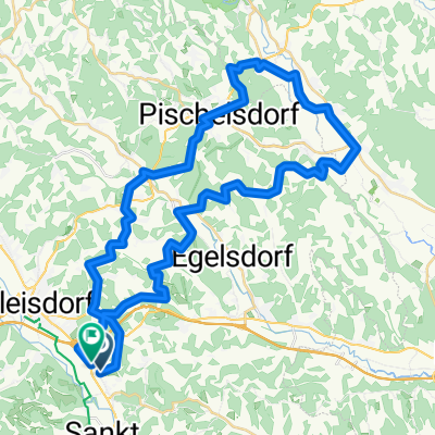 Hirnsdorftour - 51 km (Morcherl), Wolfgruben, Pischelsdorf,Hirnsdorf, Kroisbach,
- Distance
- 50.6 km
- Ascent
- 1,105 m
- Descent
- 1,106 m
- Location
- Hofstätten an der Raab, Styria, Austria
 Puch b. Weiz über St. Ruprecht ( 58 km )
- Distance
- 58.5 km
- Ascent
- 1,129 m
- Descent
- 1,138 m
- Location
- Hofstätten an der Raab, Styria, Austria
 Fasoldsberg Rundfahrt ( 63 km )
- Distance
- 62.6 km
- Ascent
- 862 m
- Descent
- 858 m
- Location
- Hofstätten an der Raab, Styria, Austria
 Weiz Runde über Prebuch, Mitterndorf, St. Ruprecht ( 51 km )
- Distance
- 51.1 km
- Ascent
- 641 m
- Descent
- 642 m
- Location
- Hofstätten an der Raab, Styria, Austria
 Ausfahrt durch Labuch
- Distance
- 13.5 km
- Ascent
- 224 m
- Descent
- 308 m
- Location
- Hofstätten an der Raab, Styria, Austria
 Kirchberg über Kleeberg
- Distance
- 31.4 km
- Ascent
- 215 m
- Descent
- 217 m
- Location
- Hofstätten an der Raab, Styria, Austria
 Stubenberg
- Distance
- 59.9 km
- Ascent
- 680 m
- Descent
- 680 m
- Location
- Hofstätten an der Raab, Styria, Austria
Open it in the app