

Chambéry-Bienne
A cycling route starting in Le Bourget-du-Lac, Auvergne-Rhône-Alpes, France.
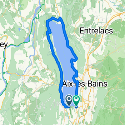
Overview
About this route
Bike tour in 5 stages from Chambéry through the Tunnel du Chat to the Rhône. Through the lake landscape of the Beaujolais to Fleurville. Briefly following the Saône, sharp right over the bridge in the direction of Lons-le-Saunier in the Jura department. The route mainly follows charming side roads and bike paths.
- -:--
- Duration
- 474.9 km
- Distance
- 4,392 m
- Ascent
- 4,188 m
- Descent
- ---
- Avg. speed
- 1,011 m
- Max. altitude

Route photos


Route quality
Waytypes & surfaces along the route
Waytypes
Quiet road
142.5 km
(30 %)
Road
95 km
(20 %)
Surfaces
Paved
280.2 km
(59 %)
Unpaved
14.2 km
(3 %)
Asphalt
275.4 km
(58 %)
Gravel
9.5 km
(2 %)
Route highlights
Points of interest along the route
Accommodation after 83.1 km
Camping de la valle bleu
Accommodation after 177.9 km
Camoing aus Rives du Soleil
Point of interest after 192 km
Bäkerei
Accommodation after 263.4 km
Camping

Photo after 272.5 km
Rassante Abfahrt

Photo after 278.7 km
Château Chalon

Photo after 286 km
Château Chalon

Photo after 332.1 km
Stadttor
Accommodation after 339.9 km
Auberge Loisirs Le Sillet
Accommodation after 407.3 km
Camping à la ferme La Coué
Continue with Bikemap
Use, edit, or download this cycling route
You would like to ride Chambéry-Bienne or customize it for your own trip? Here is what you can do with this Bikemap route:
Free features
- Save this route as favorite or in collections
- Copy & plan your own version of this route
- Split it into stages to create a multi-day tour
- Sync your route with Garmin or Wahoo
Premium features
Free trial for 3 days, or one-time payment. More about Bikemap Premium.
- Navigate this route on iOS & Android
- Export a GPX / KML file of this route
- Create your custom printout (try it for free)
- Download this route for offline navigation
Discover more Premium features.
Get Bikemap PremiumFrom our community
Other popular routes starting in Le Bourget-du-Lac
 Bourget
- Distance
- 49.5 km
- Ascent
- 670 m
- Descent
- 672 m
- Location
- Le Bourget-du-Lac, Auvergne-Rhône-Alpes, France
 boulot_Aix_AR_piste_cyclable
- Distance
- 21.6 km
- Ascent
- 13 m
- Descent
- 12 m
- Location
- Le Bourget-du-Lac, Auvergne-Rhône-Alpes, France
 Stage3_2Draft_Ain17
- Distance
- 97.5 km
- Ascent
- 2,375 m
- Descent
- 2,172 m
- Location
- Le Bourget-du-Lac, Auvergne-Rhône-Alpes, France
 MONT du CHAT, por Le Bourget du Lac
- Distance
- 13.6 km
- Ascent
- 1,254 m
- Descent
- 0 m
- Location
- Le Bourget-du-Lac, Auvergne-Rhône-Alpes, France
 opdecahier_lacdubourget2004_04
- Distance
- 71.8 km
- Ascent
- 1,782 m
- Descent
- 1,173 m
- Location
- Le Bourget-du-Lac, Auvergne-Rhône-Alpes, France
 INES- Entre Deux Guiers via l'antenne du chat
- Distance
- 59 km
- Ascent
- 1,627 m
- Descent
- 1,473 m
- Location
- Le Bourget-du-Lac, Auvergne-Rhône-Alpes, France
 Mont du Chat and Col du Chat
- Distance
- 41.1 km
- Ascent
- 1,544 m
- Descent
- 1,544 m
- Location
- Le Bourget-du-Lac, Auvergne-Rhône-Alpes, France
 INES- Entre Deux Guiers via col du chat
- Distance
- 56.2 km
- Ascent
- 1,034 m
- Descent
- 881 m
- Location
- Le Bourget-du-Lac, Auvergne-Rhône-Alpes, France
Open it in the app