

Montafron Mountainbike Marathon M3 - extrem
A cycling route starting in Schruns, Vorarlberg, Austria.
Overview
About this route
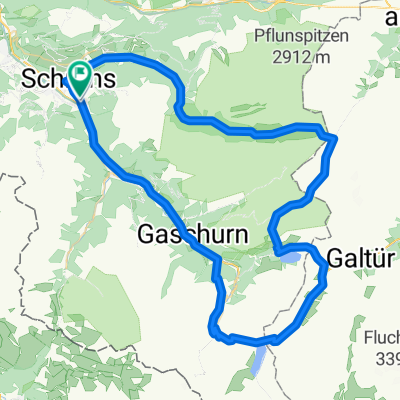
Schruns – Silbertal – Kristberg – Rellseck – Bartholomäberg – Gantschier – Vandans – Matschwitz – Latschau – Bitschweil – Tschagguns – St. Gallenkirch – Gaschurn – Partenen – Kops – Wirl – Bilerhöhe – Partenen – Gaschurn – St. Gallenkirch – Schruns
- -:--
- Duration
- 135.4 km
- Distance
- 3,280 m
- Ascent
- 3,279 m
- Descent
- ---
- Avg. speed
- ---
- Max. altitude

Route highlights
Points of interest along the route
Point of interest after 20.1 km
Zwischenzeit Kristberg
Point of interest after 21.3 km
TAZ01 Kristberg
Point of interest after 26.9 km
Trennung zwischen Strecken M1 und M2/M3
Point of interest after 38.4 km
TAZ02 Bartholomäberg
Point of interest after 42.8 km
Zwischenzeit Gantschier
Point of interest after 42.8 km
Zeitlimit Gantschier 13:00 Uhr
Point of interest after 45.8 km
TAZ03 Vandans
Point of interest after 55.3 km
TAZ04 Latschau
Point of interest after 65 km
Zeitlimit Stemer Brücke 12:15 Uhr
Point of interest after 75.4 km
TAZ 05 Tennisplatz Gortipohl
Point of interest after 84.8 km
Zeitlimit Partenen: 14:00 Uhr
Point of interest after 96.6 km
TAZ07 Wirl
Point of interest after 103.8 km
Zwischenzeit Bielerhöhe
Point of interest after 113.3 km
TAZ06 und TAZ08 Silvretta Hochalpenstr. Kehre 2
Point of interest after 123.9 km
TAZ 09 Base Montafon
Point of interest after 132.5 km
Trennung Strecke M1/M2 und M3/Mfit
Continue with Bikemap
Use, edit, or download this cycling route
You would like to ride Montafron Mountainbike Marathon M3 - extrem or customize it for your own trip? Here is what you can do with this Bikemap route:
Free features
- Save this route as favorite or in collections
- Copy & plan your own version of this route
- Split it into stages to create a multi-day tour
- Sync your route with Garmin or Wahoo
Premium features
Free trial for 3 days, or one-time payment. More about Bikemap Premium.
- Navigate this route on iOS & Android
- Export a GPX / KML file of this route
- Create your custom printout (try it for free)
- Download this route for offline navigation
Discover more Premium features.
Get Bikemap PremiumFrom our community
Other popular routes starting in Schruns
 M3 - extrem Montafon Mountainbike Marathon // Teilstrecken nur am Renntag befahrbar!
- Distance
- 134.5 km
- Ascent
- 4,344 m
- Descent
- 4,342 m
- Location
- Schruns, Vorarlberg, Austria
 Schruns-Saarbrücker hütte
- Distance
- 69.1 km
- Ascent
- 1,871 m
- Descent
- 1,875 m
- Location
- Schruns, Vorarlberg, Austria
 schruns partenen heilbronner hütte silbertal schruns
- Distance
- 75.8 km
- Ascent
- 2,255 m
- Descent
- 2,258 m
- Location
- Schruns, Vorarlberg, Austria
 Tschagguns - Latschau - Vadans - Schruns
- Distance
- 24.6 km
- Ascent
- 984 m
- Descent
- 986 m
- Location
- Schruns, Vorarlberg, Austria
 2011_2_Vorarlberg-Tirol-Allgäu-Runde (BAFGOR)_Tschagguns - See
- Distance
- 74.9 km
- Ascent
- 1,398 m
- Descent
- 1,068 m
- Location
- Schruns, Vorarlberg, Austria
 Mein erster Alpenpass vom 17. August 2017
- Distance
- 157.3 km
- Ascent
- 4,742 m
- Descent
- 4,730 m
- Location
- Schruns, Vorarlberg, Austria
 Vandans - Schweizer Tor - Lindauer Hütte
- Distance
- 35.4 km
- Ascent
- 1,680 m
- Descent
- 1,687 m
- Location
- Schruns, Vorarlberg, Austria
 schruns partenen heilbronner hütte silbertal schruns
- Distance
- 75.7 km
- Ascent
- 2,289 m
- Descent
- 2,290 m
- Location
- Schruns, Vorarlberg, Austria
Open it in the app