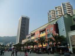
Fok Tin to Water World
A cycling route starting in Yuen Long Kau Hui, Yuen Long District, Hong Kong.
Overview
About this route
- -:--
- Duration
- 21.5 km
- Distance
- 38 m
- Ascent
- 41 m
- Descent
- ---
- Avg. speed
- ---
- Max. altitude
Route highlights
Points of interest along the route

Point of interest after 5.7 km
Green Way Starting Point

Point of interest after 7.8 km

Point of interest after 9 km

Point of interest after 10.4 km

Point of interest after 11.2 km

Point of interest after 13.1 km

Point of interest after 14.8 km

Point of interest after 18.8 km
Lunch _delicious of Fish

Point of interest after 20.2 km

Point of interest after 21.5 km
Continue with Bikemap
Use, edit, or download this cycling route
You would like to ride Fok Tin to Water World or customize it for your own trip? Here is what you can do with this Bikemap route:
Free features
- Save this route as favorite or in collections
- Copy & plan your own version of this route
- Sync your route with Garmin or Wahoo
Premium features
Free trial for 3 days, or one-time payment. More about Bikemap Premium.
- Navigate this route on iOS & Android
- Export a GPX / KML file of this route
- Create your custom printout (try it for free)
- Download this route for offline navigation
Discover more Premium features.
Get Bikemap PremiumFrom our community
Other popular routes starting in Yuen Long Kau Hui
 ÄåÛˇ?到ÄåÛˇ?
- Distance
- 13.9 km
- Ascent
- 0 m
- Descent
- 7 m
- Location
- Yuen Long Kau Hui, Yuen Long District, Hong Kong
 元朗- 河背-雷公田
- Distance
- 15.2 km
- Ascent
- 244 m
- Descent
- 202 m
- Location
- Yuen Long Kau Hui, Yuen Long District, Hong Kong
 元朗天水圍洪水橋
- Distance
- 19.2 km
- Ascent
- 199 m
- Descent
- 201 m
- Location
- Yuen Long Kau Hui, Yuen Long District, Hong Kong
 流浮山天水圍
- Distance
- 12 km
- Ascent
- 20 m
- Descent
- 12 m
- Location
- Yuen Long Kau Hui, Yuen Long District, Hong Kong
 Tin Shui Road 73 to Choi Yuen Road
- Distance
- 29.4 km
- Ascent
- 11 m
- Descent
- 22 m
- Location
- Yuen Long Kau Hui, Yuen Long District, Hong Kong
 午后骑行 - Frankie
- Distance
- 108.4 km
- Ascent
- 1,863 m
- Descent
- 1,895 m
- Location
- Yuen Long Kau Hui, Yuen Long District, Hong Kong
 Nam Sang Wai Road, Yuen Long to Kam Tai Road, Pat Heung
- Distance
- 18.1 km
- Ascent
- 0 m
- Descent
- 3 m
- Location
- Yuen Long Kau Hui, Yuen Long District, Hong Kong
 南生圍-->尖鼻嘴
- Distance
- 22.7 km
- Ascent
- 173 m
- Descent
- 173 m
- Location
- Yuen Long Kau Hui, Yuen Long District, Hong Kong
Open it in the app

