
hgjhvv
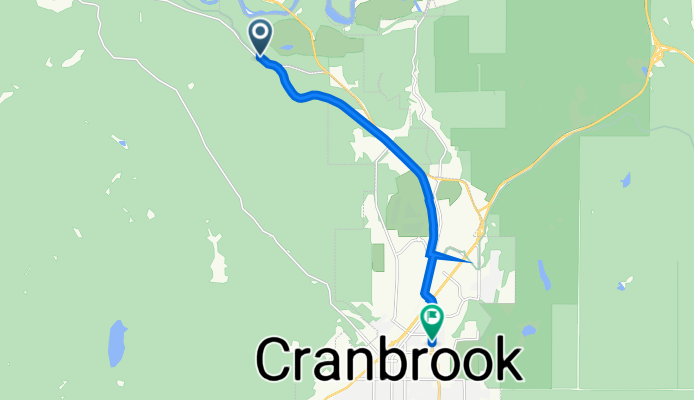
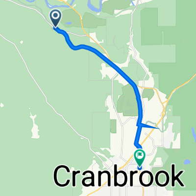
A cycling route starting in Cranbrook, British Columbia, Canada.
Overview
About this route
- 1 h 2 min
- Duration
- 8.9 km
- Distance
- 75 m
- Ascent
- 68 m
- Descent
- 8.6 km/h
- Avg. speed
- 959 m
- Max. altitude

Route quality
Waytypes & surfaces along the route
Waytypes
Cycleway
5.9 km
(66 %)
Road
1.5 km
(17 %)
Undefined
1.5 km
(17 %)
Surfaces
Paved
8.9 km
(100 %)
Paved (undefined)
7.5 km
(84 %)
Asphalt
1.4 km
(16 %)
Continue with Bikemap
Use, edit, or download this cycling route
You would like to ride hgjhvv or customize it for your own trip? Here is what you can do with this Bikemap route:
Free features
- Save this route as favorite or in collections
- Copy & plan your own version of this route
- Sync your route with Garmin or Wahoo
Premium features
Free trial for 3 days, or one-time payment. More about Bikemap Premium.
- Navigate this route on iOS & Android
- Export a GPX / KML file of this route
- Create your custom printout (try it for free)
- Download this route for offline navigation
Discover more Premium features.
Get Bikemap PremiumFrom our community
Other popular routes starting in Cranbrook
 hgjhvv
- Distance
- 8.9 km
- Ascent
- 75 m
- Descent
- 68 m
- Location
- Cranbrook, British Columbia, Canada
 Interm (proposed) regional cycle route Cranbrook to Kimberly, BC
- Distance
- 27.8 km
- Ascent
- 370 m
- Descent
- 147 m
- Location
- Cranbrook, British Columbia, Canada
 Option 2 Cranbrook -Creston
- Distance
- 109.5 km
- Ascent
- 437 m
- Descent
- 708 m
- Location
- Cranbrook, British Columbia, Canada
 Medio Fondo
- Distance
- 102 km
- Ascent
- 717 m
- Descent
- 717 m
- Location
- Cranbrook, British Columbia, Canada
 Can11 Cranbrook Sparwood
- Distance
- 132.4 km
- Ascent
- 603 m
- Descent
- 382 m
- Location
- Cranbrook, British Columbia, Canada
 Across Canada Trails - Proposed Paved Route - Cranbrook to Fernie, BC
- Distance
- 109.1 km
- Ascent
- 1,278 m
- Descent
- 1,207 m
- Location
- Cranbrook, British Columbia, Canada
 Canada Day 18A: Cranbrook to Kimberley to Kootenay Bay to Nelson
- Distance
- 152.8 km
- Ascent
- 1,322 m
- Descent
- 1,655 m
- Location
- Cranbrook, British Columbia, Canada
 CranbrookRailTrailMissionWycliffeLoop CLONED FROM ROUTE 531251
- Distance
- 28 km
- Ascent
- 271 m
- Descent
- 269 m
- Location
- Cranbrook, British Columbia, Canada
Open it in the app