

Sorocaba - Fazenda Ipanema
A cycling route starting in Sorocaba, São Paulo, Brazil.
Overview
About this route
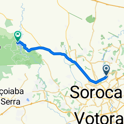
Essa rota é de Sorocaba até a Fazenda Ipanema, indo pela General Carneiro e Armando Panunzio. Apesar de ser um caminho longo ele é mais seguro para iniciantes pois utiliza a Rodovia Raposo Tavarez para chegar até a Fazenda.
- -:--
- Duration
- 33.3 km
- Distance
- 264 m
- Ascent
- 285 m
- Descent
- ---
- Avg. speed
- ---
- Max. altitude
Route highlights
Points of interest along the route
Point of interest after 0 km
Encontro mercado Seriema Ibikers!
Point of interest after 33.3 km
Fazenda Ipanema
Continue with Bikemap
Use, edit, or download this cycling route
You would like to ride Sorocaba - Fazenda Ipanema or customize it for your own trip? Here is what you can do with this Bikemap route:
Free features
- Save this route as favorite or in collections
- Copy & plan your own version of this route
- Sync your route with Garmin or Wahoo
Premium features
Free trial for 3 days, or one-time payment. More about Bikemap Premium.
- Navigate this route on iOS & Android
- Export a GPX / KML file of this route
- Create your custom printout (try it for free)
- Download this route for offline navigation
Discover more Premium features.
Get Bikemap PremiumFrom our community
Other popular routes starting in Sorocaba
 Estrada Velha de Salto de Pirapora
- Distance
- 44.6 km
- Ascent
- 441 m
- Descent
- 440 m
- Location
- Sorocaba, São Paulo, Brazil
 Primeiro Pedal em Sorocaba
- Distance
- 14 km
- Ascent
- 330 m
- Descent
- 342 m
- Location
- Sorocaba, São Paulo, Brazil
 De Rua Antônio Aparecido Ferraz 546 a Rua Tobias Avino 73
- Distance
- 6.2 km
- Ascent
- 47 m
- Descent
- 86 m
- Location
- Sorocaba, São Paulo, Brazil
 Sorocaba » Reserva Itupararanga » Trilha » Cachoeira da Chave
- Distance
- 56.3 km
- Ascent
- 619 m
- Descent
- 619 m
- Location
- Sorocaba, São Paulo, Brazil
 hause
hause- Distance
- 7.2 km
- Ascent
- 140 m
- Descent
- 106 m
- Location
- Sorocaba, São Paulo, Brazil
 Sorocaba / Votorantim
- Distance
- 17.1 km
- Ascent
- 339 m
- Descent
- 342 m
- Location
- Sorocaba, São Paulo, Brazil
 Rota para Unnamed Road, Mairinque - SP, Brasil
- Distance
- 20.8 km
- Ascent
- 5 m
- Descent
- 11 m
- Location
- Sorocaba, São Paulo, Brazil
 Sorocaba - Fazenda Ipanema
- Distance
- 17.9 km
- Ascent
- 224 m
- Descent
- 239 m
- Location
- Sorocaba, São Paulo, Brazil
Open it in the app