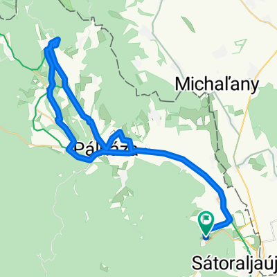
18.1 TOURING PÁlháza-Pusztaf-Füzér-Hollóh-Aszfalt
A cycling route starting in Sátoraljaújhely, Borsod-Abauj Zemplen county, Hungary.
Overview
About this route
- -:--
- Duration
- 22.6 km
- Distance
- 459 m
- Ascent
- 301 m
- Descent
- ---
- Avg. speed
- 443 m
- Avg. speed
Route quality
Waytypes & surfaces along the route
Waytypes
Busy road
8.7 km
(38 %)
Road
6.5 km
(29 %)
Surfaces
Paved
3.1 km
(14 %)
Unpaved
1.9 km
(8 %)
Asphalt
3.1 km
(14 %)
Ground
1.5 km
(7 %)
Continue with Bikemap
Use, edit, or download this cycling route
You would like to ride 18.1 TOURING PÁlháza-Pusztaf-Füzér-Hollóh-Aszfalt or customize it for your own trip? Here is what you can do with this Bikemap route:
Free features
- Save this route as favorite or in collections
- Copy & plan your own version of this route
- Sync your route with Garmin or Wahoo
Premium features
Free trial for 3 days, or one-time payment. More about Bikemap Premium.
- Navigate this route on iOS & Android
- Export a GPX / KML file of this route
- Create your custom printout (try it for free)
- Download this route for offline navigation
Discover more Premium features.
Get Bikemap PremiumFrom our community
Other popular routes starting in Sátoraljaújhely
- Megyeri tengerszem, Zemplén földutakon
- Distance
- 51.4 km
- Ascent
- 830 m
- Descent
- 827 m
- Location
- Sátoraljaújhely, Borsod-Abauj Zemplen county, Hungary
- Aszfalt Zemplén Kör 70KM
- Distance
- 70.5 km
- Ascent
- 1,122 m
- Descent
- 1,126 m
- Location
- Sátoraljaújhely, Borsod-Abauj Zemplen county, Hungary
- Pálháza_Kéked_Pálháza
- Distance
- 57.4 km
- Ascent
- 818 m
- Descent
- 820 m
- Location
- Sátoraljaújhely, Borsod-Abauj Zemplen county, Hungary
- stereo jó kör!!
- Distance
- 43.7 km
- Ascent
- 1,321 m
- Descent
- 1,310 m
- Location
- Sátoraljaújhely, Borsod-Abauj Zemplen county, Hungary
- Sátoraljaújhely to Fő utca 117, Tiszakanyár
- Distance
- 60.1 km
- Ascent
- 243 m
- Descent
- 294 m
- Location
- Sátoraljaújhely, Borsod-Abauj Zemplen county, Hungary
- Zemplen - 3 kilato
- Distance
- 76.6 km
- Ascent
- 787 m
- Descent
- 781 m
- Location
- Sátoraljaújhely, Borsod-Abauj Zemplen county, Hungary
- Kis hegyköz kör
- Distance
- 23 km
- Ascent
- 228 m
- Descent
- 228 m
- Location
- Sátoraljaújhely, Borsod-Abauj Zemplen county, Hungary
- OKT Nagy-Milici Kék 1
- Distance
- 16.1 km
- Ascent
- 640 m
- Descent
- 551 m
- Location
- Sátoraljaújhely, Borsod-Abauj Zemplen county, Hungary