

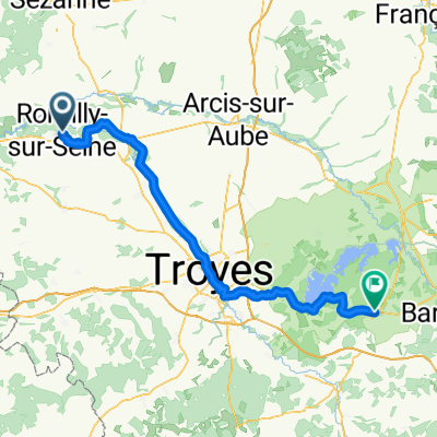
circuit des lacs grand est - 3 à 4 jours
A cycling route starting in Romilly-sur-Seine, Grand Est, France.
Overview
About this route
- 14 h 58 min
- Duration
- 250.8 km
- Distance
- 1,050 m
- Ascent
- 801 m
- Descent
- 16.8 km/h
- Avg. speed
- 327 m
- Max. altitude
Route quality
Waytypes & surfaces along the route
Waytypes
Cycleway
90.8 km
(36 %)
Path
43.5 km
(17 %)
Surfaces
Paved
153.7 km
(61 %)
Unpaved
1.7 km
(<1 %)
Asphalt
113.7 km
(45 %)
Paved (undefined)
40 km
(16 %)
Continue with Bikemap
Use, edit, or download this cycling route
You would like to ride circuit des lacs grand est - 3 à 4 jours or customize it for your own trip? Here is what you can do with this Bikemap route:
Free features
- Save this route as favorite or in collections
- Copy & plan your own version of this route
- Split it into stages to create a multi-day tour
- Sync your route with Garmin or Wahoo
Premium features
Free trial for 3 days, or one-time payment. More about Bikemap Premium.
- Navigate this route on iOS & Android
- Export a GPX / KML file of this route
- Create your custom printout (try it for free)
- Download this route for offline navigation
Discover more Premium features.
Get Bikemap PremiumFrom our community
Other popular routes starting in Romilly-sur-Seine
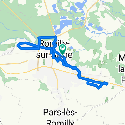
 Romilly / Sud Ouest marnais
- Distance
- 21.2 km
- Ascent
- 29 m
- Descent
- 28 m
- Location
- Romilly-sur-Seine, Grand Est, France
 france 2009-10 romilly sur seine-provins
- Distance
- 40.3 km
- Ascent
- 145 m
- Descent
- 128 m
- Location
- Romilly-sur-Seine, Grand Est, France
 romilly troyes
- Distance
- 40.4 km
- Ascent
- 49 m
- Descent
- 14 m
- Location
- Romilly-sur-Seine, Grand Est, France
 TdP Tag #4
- Distance
- 125.4 km
- Ascent
- 341 m
- Descent
- 380 m
- Location
- Romilly-sur-Seine, Grand Est, France
 day 3 trip
- Distance
- 90.3 km
- Ascent
- 221 m
- Descent
- 146 m
- Location
- Romilly-sur-Seine, Grand Est, France
 Aadorf - Paris 9. Tag Saint-Hilaire-sous-Romilly - Veneux-les-Sablons
- Distance
- 75 km
- Ascent
- 112 m
- Descent
- 126 m
- Location
- Romilly-sur-Seine, Grand Est, France
 Parcours Romilly intra-muros
- Distance
- 14.9 km
- Ascent
- 19 m
- Descent
- 17 m
- Location
- Romilly-sur-Seine, Grand Est, France
 De Rue Gornet Boivin 108, Romilly-sur-Seine à Rue Gornet Boivin 126, Romilly-sur-Seine
- Distance
- 22.5 km
- Ascent
- 22 m
- Descent
- 21 m
- Location
- Romilly-sur-Seine, Grand Est, France
Open it in the app