
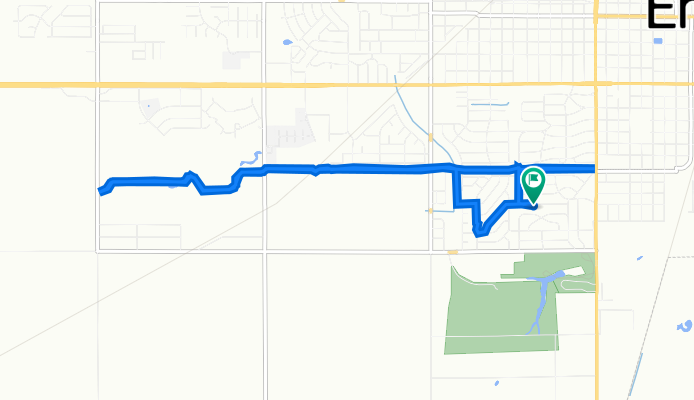
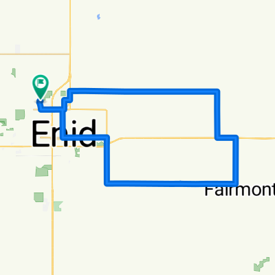
1417 W Thompson Ave, Enid to 1417 W Thompson Ave, Enid
A cycling route starting in Enid, Oklahoma, United States of America.
Overview
About this route
- 39 min
- Duration
- 11.8 km
- Distance
- 64 m
- Ascent
- 65 m
- Descent
- 18.2 km/h
- Avg. speed
- 395 m
- Max. altitude
Route quality
Waytypes & surfaces along the route
Waytypes
Cycleway
9.9 km
(84 %)
Quiet road
1.4 km
(12 %)
Surfaces
Paved
10.3 km
(87 %)
Concrete
6.1 km
(52 %)
Paved (undefined)
3.8 km
(32 %)
Continue with Bikemap
Use, edit, or download this cycling route
You would like to ride 1417 W Thompson Ave, Enid to 1417 W Thompson Ave, Enid or customize it for your own trip? Here is what you can do with this Bikemap route:
Free features
- Save this route as favorite or in collections
- Copy & plan your own version of this route
- Sync your route with Garmin or Wahoo
Premium features
Free trial for 3 days, or one-time payment. More about Bikemap Premium.
- Navigate this route on iOS & Android
- Export a GPX / KML file of this route
- Create your custom printout (try it for free)
- Download this route for offline navigation
Discover more Premium features.
Get Bikemap PremiumFrom our community
Other popular routes starting in Enid
 test1
test1- Distance
- 13.4 km
- Ascent
- 13 m
- Descent
- 10 m
- Location
- Enid, Oklahoma, United States of America
 USA 96/36
- Distance
- 115.2 km
- Ascent
- 853 m
- Descent
- 957 m
- Location
- Enid, Oklahoma, United States of America
 Steady ride in Enid
- Distance
- 10 km
- Ascent
- 0 m
- Descent
- 0 m
- Location
- Enid, Oklahoma, United States of America
 bike tour through Enid
- Distance
- 20.1 km
- Ascent
- 23 m
- Descent
- 23 m
- Location
- Enid, Oklahoma, United States of America
 Steady ride in Enid
- Distance
- 8 km
- Ascent
- 37 m
- Descent
- 37 m
- Location
- Enid, Oklahoma, United States of America
 921 N Independence St, Enid to 125 W Locust Ave, Enid
- Distance
- 7.7 km
- Ascent
- 23 m
- Descent
- 22 m
- Location
- Enid, Oklahoma, United States of America
 3326 Chisholm Trail, Enid to 3326 Chisholm Trail, Enid
- Distance
- 6.9 km
- Ascent
- 10 m
- Descent
- 9 m
- Location
- Enid, Oklahoma, United States of America
 fairmont/breckenridge
- Distance
- 52 km
- Ascent
- 89 m
- Descent
- 88 m
- Location
- Enid, Oklahoma, United States of America
Open it in the app