

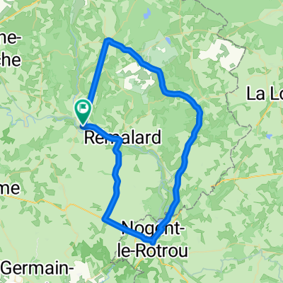
Maison-Maugis - Vendome
A cycling route starting in Rémalard, Normandy, France.
Overview
About this route
- -:--
- Duration
- 103.9 km
- Distance
- 661 m
- Ascent
- 710 m
- Descent
- ---
- Avg. speed
- 278 m
- Max. altitude
Route quality
Waytypes & surfaces along the route
Waytypes
Road
55.2 km
(53 %)
Quiet road
16.4 km
(16 %)
Surfaces
Paved
33.5 km
(32 %)
Unpaved
15.7 km
(15 %)
Asphalt
32.7 km
(31 %)
Gravel
15.4 km
(15 %)
Continue with Bikemap
Use, edit, or download this cycling route
You would like to ride Maison-Maugis - Vendome or customize it for your own trip? Here is what you can do with this Bikemap route:
Free features
- Save this route as favorite or in collections
- Copy & plan your own version of this route
- Split it into stages to create a multi-day tour
- Sync your route with Garmin or Wahoo
Premium features
Free trial for 3 days, or one-time payment. More about Bikemap Premium.
- Navigate this route on iOS & Android
- Export a GPX / KML file of this route
- Create your custom printout (try it for free)
- Download this route for offline navigation
Discover more Premium features.
Get Bikemap PremiumFrom our community
Other popular routes starting in Rémalard
 De Rue des Moulins à Place du Général de Gaulle
- Distance
- 25.3 km
- Ascent
- 171 m
- Descent
- 100 m
- Location
- Rémalard, Normandy, France
 Belleme 31km
- Distance
- 30.9 km
- Ascent
- 478 m
- Descent
- 484 m
- Location
- Rémalard, Normandy, France
 Maison-Maugis - Vendome
- Distance
- 103.9 km
- Ascent
- 661 m
- Descent
- 710 m
- Location
- Rémalard, Normandy, France
 F 15 Maison-Maugies - Ermenonville-la-Petite
- Distance
- 77.9 km
- Ascent
- 606 m
- Descent
- 585 m
- Location
- Rémalard, Normandy, France
 Etape 14 Nogent-le-Rotrou/Illiers-Combray 50Km/330m
- Distance
- 48.1 km
- Ascent
- 355 m
- Descent
- 356 m
- Location
- Rémalard, Normandy, France
 Recovered Route
- Distance
- 178.4 km
- Ascent
- 2,243 m
- Descent
- 2,226 m
- Location
- Rémalard, Normandy, France
 Allenamento
- Distance
- 63.7 km
- Ascent
- 328 m
- Descent
- 328 m
- Location
- Rémalard, Normandy, France
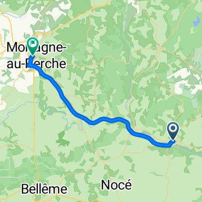
 Stage 12 Rémalard to Mortagne-au-Perche
- Distance
- 23.3 km
- Ascent
- 125 m
- Descent
- 47 m
- Location
- Rémalard, Normandy, France
Open it in the app