

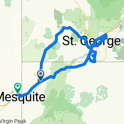
111 mile Mesquite SWUtah NWAz loop
A cycling route starting in Beaver Dam, Arizona, United States.
Overview
About this route
- -:--
- Duration
- 152.5 km
- Distance
- 2,499 m
- Ascent
- 2,561 m
- Descent
- ---
- Avg. speed
- ---
- Max. altitude
Continue with Bikemap
Use, edit, or download this cycling route
You would like to ride 111 mile Mesquite SWUtah NWAz loop or customize it for your own trip? Here is what you can do with this Bikemap route:
Free features
- Save this route as favorite or in collections
- Copy & plan your own version of this route
- Split it into stages to create a multi-day tour
- Sync your route with Garmin or Wahoo
Premium features
Free trial for 3 days, or one-time payment. More about Bikemap Premium.
- Navigate this route on iOS & Android
- Export a GPX / KML file of this route
- Create your custom printout (try it for free)
- Download this route for offline navigation
Discover more Premium features.
Get Bikemap PremiumFrom our community
Other popular routes starting in Beaver Dam
 County Highway to Jade Street
- Distance
- 197.2 km
- Ascent
- 1,732 m
- Descent
- 1,744 m
- Location
- Beaver Dam, Arizona, United States
 st goerge to caliente draft
- Distance
- 106 km
- Ascent
- 1,633 m
- Descent
- 780 m
- Location
- Beaver Dam, Arizona, United States
 111 mile Mesquite SWUtah NWAz loop
- Distance
- 152.5 km
- Ascent
- 2,499 m
- Descent
- 2,561 m
- Location
- Beaver Dam, Arizona, United States
 Dag 016 Vigin River Recreation Area - St George
- Distance
- 60.1 km
- Ascent
- 608 m
- Descent
- 306 m
- Location
- Beaver Dam, Arizona, United States
Open it in the app