

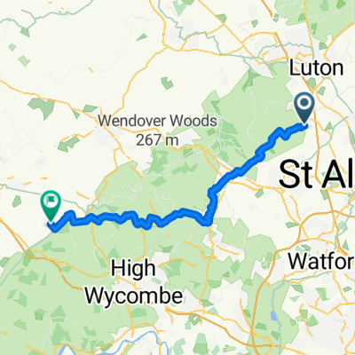
Chiltern Cycleway - Berkhamsted
A cycling route starting in Flamstead, England, United Kingdom.
Overview
About this route
- -:--
- Duration
- 38.4 km
- Distance
- 490 m
- Ascent
- 502 m
- Descent
- ---
- Avg. speed
- 214 m
- Max. altitude
Route quality
Waytypes & surfaces along the route
Waytypes
Quiet road
24.2 km
(63 %)
Road
7.3 km
(19 %)
Surfaces
Paved
1.5 km
(4 %)
Unpaved
3.5 km
(9 %)
Ground
1.9 km
(5 %)
Asphalt
1.5 km
(4 %)
Continue with Bikemap
Use, edit, or download this cycling route
You would like to ride Chiltern Cycleway - Berkhamsted or customize it for your own trip? Here is what you can do with this Bikemap route:
Free features
- Save this route as favorite or in collections
- Copy & plan your own version of this route
- Sync your route with Garmin or Wahoo
Premium features
Free trial for 3 days, or one-time payment. More about Bikemap Premium.
- Navigate this route on iOS & Android
- Export a GPX / KML file of this route
- Create your custom printout (try it for free)
- Download this route for offline navigation
Discover more Premium features.
Get Bikemap PremiumFrom our community
Other popular routes starting in Flamstead
 Whitehouse Farm, Gaddesden Row, Hemel Hempstead to 21 Farm Crescent, St Albans
- Distance
- 19.7 km
- Ascent
- 81 m
- Descent
- 162 m
- Location
- Flamstead, England, United Kingdom
 Ledgemore Lane, Great Gaddesden, Hemel Hempstead to 13A Catherine St, St Albans
- Distance
- 19 km
- Ascent
- 223 m
- Descent
- 262 m
- Location
- Flamstead, England, United Kingdom
 Old Chequers, Hemel Hempstead to 1–99 Shepherd's Row, Redbourn, St Albans
- Distance
- 14.7 km
- Ascent
- 93 m
- Descent
- 147 m
- Location
- Flamstead, England, United Kingdom
 From Saint Albans to Chinnor
- Distance
- 51.1 km
- Ascent
- 660 m
- Descent
- 678 m
- Location
- Flamstead, England, United Kingdom
 40 Singlets Lane, St Albans to 37 Barnsley Wood Rise, Harlow
- Distance
- 51.9 km
- Ascent
- 279 m
- Descent
- 339 m
- Location
- Flamstead, England, United Kingdom
 Route from Lane House, Gaddesden Row, Hemel Hempstead
- Distance
- 10.1 km
- Ascent
- 123 m
- Descent
- 67 m
- Location
- Flamstead, England, United Kingdom
 Le Grand Tour day 3 (v2)
- Distance
- 83.5 km
- Ascent
- 882 m
- Descent
- 940 m
- Location
- Flamstead, England, United Kingdom
 Dunstaple to Lutterworth
- Distance
- 98.5 km
- Ascent
- 440 m
- Descent
- 424 m
- Location
- Flamstead, England, United Kingdom
Open it in the app