

route 1 - Figure of 8 or a ride of two halves
A cycling route starting in Hulme, England, United Kingdom.
Overview
About this route
A cycling route of 4 miles taking in four local parks and using quiet roads and signed cycle routes. The route can be halved at the Warwick Rd South/Talbot Road junction
- -:--
- Duration
- 6.7 km
- Distance
- 34 m
- Ascent
- 32 m
- Descent
- ---
- Avg. speed
- 44 m
- Max. altitude

Route quality
Waytypes & surfaces along the route
Waytypes
Quiet road
3.4 km
(51 %)
Pedestrian area
0.7 km
(10 %)
Surfaces
Paved
3.2 km
(48 %)
Asphalt
3.2 km
(48 %)
Undefined
3.5 km
(52 %)
Route highlights
Points of interest along the route

Photo after 0 km
The two main flower beds in the park are planted and maintained by the Friends of Hullard Park
Point of interest after 0.1 km
1) Cross Park Avenue to Walter St, turn right onto Fulford St
Point of interest after 0.5 km
Together mural
Bike service after 1.5 km
2) Take care crossing tram tracks at Old Trafford metrolink station
Point of interest after 1.8 km
Trafford Town Hall
Bike service after 2.1 km
4) Route 3 can be joined at Wharfside tram stop by going straight on past the football stadium and down the hill.
Bike service after 2.1 km
3) Turn left before railway bridge onto Railway Rd, follow blue cycle route
Point of interest after 2.2 km
Mural of Mary Earps
Point of interest after 2.8 km
Knitted hat post box
Bike service after 3.5 km
6) Turn left onto Taylor’s Rd cycleway, cross at pedestrian crossing to Gorse Hill Park
Bike service after 3.8 km
Pedestrian crossing
Point of interest after 4 km
Great Stone
Point of interest after 5.1 km
Old Trafford Bowling Club
Bike service after 6.6 km
8) From Stretford Rd, turn right onto Henrietta St, signed Hullard Park
Point of interest after 6.7 km
Wildflower meadow and hidden garden
Continue with Bikemap
Use, edit, or download this cycling route
You would like to ride route 1 - Figure of 8 or a ride of two halves or customize it for your own trip? Here is what you can do with this Bikemap route:
Free features
- Save this route as favorite or in collections
- Copy & plan your own version of this route
- Sync your route with Garmin or Wahoo
Premium features
Free trial for 3 days, or one-time payment. More about Bikemap Premium.
- Navigate this route on iOS & Android
- Export a GPX / KML file of this route
- Create your custom printout (try it for free)
- Download this route for offline navigation
Discover more Premium features.
Get Bikemap PremiumFrom our community
Other popular routes starting in Hulme
 2 Blackley Street, Manchester to 121 Lapwing Lane, Manchester
- Distance
- 8 km
- Ascent
- 3 m
- Descent
- 0 m
- Location
- Hulme, England, United Kingdom
 Trafford Centre & Back (via Manchester City Centre & Salford Quays)
- Distance
- 30.4 km
- Ascent
- 65 m
- Descent
- 65 m
- Location
- Hulme, England, United Kingdom
 AQA to Churchill Avenue 18, Culcheth
- Distance
- 88.1 km
- Ascent
- 0 m
- Descent
- 79 m
- Location
- Hulme, England, United Kingdom
 Manchester Loop
- Distance
- 18.5 km
- Ascent
- 51 m
- Descent
- 37 m
- Location
- Hulme, England, United Kingdom
 Manchester - Bakewell
- Distance
- 85 km
- Ascent
- 1,267 m
- Descent
- 1,152 m
- Location
- Hulme, England, United Kingdom
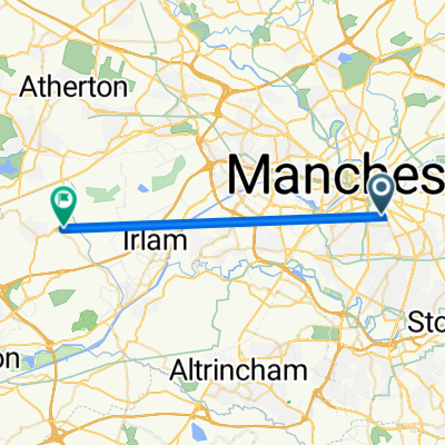
 180 Russell St, Manchester to 8 Penelope Road, Salford
- Distance
- 9.5 km
- Ascent
- 77 m
- Descent
- 42 m
- Location
- Hulme, England, United Kingdom
 to Reddish Vale Country Park from Home
- Distance
- 13.1 km
- Ascent
- 66 m
- Descent
- 34 m
- Location
- Hulme, England, United Kingdom
 Manchester Circular
- Distance
- 50.2 km
- Ascent
- 85 m
- Descent
- 86 m
- Location
- Hulme, England, United Kingdom
Open it in the app