

Laxfield Low House - East (A-B 29 miles)
A cycling route starting in Cookley, England, United Kingdom.
Overview
About this route
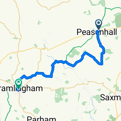
Return route from Low House via Badingham, Bruisyard, Sweffling, Great Glemham, Marlesford, Campsea Ashe, Pettistree, Bredfield, Hasketon, Great Bealings and Tuddenham.
- -:--
- Duration
- 46.3 km
- Distance
- 294 m
- Ascent
- 293 m
- Descent
- ---
- Avg. speed
- 56 m
- Max. altitude
Route quality
Waytypes & surfaces along the route
Waytypes
Quiet road
31.5 km
(68 %)
Road
13 km
(28 %)
Undefined
1.9 km
(4 %)
Surfaces
Paved
2.8 km
(6 %)
Asphalt
2.8 km
(6 %)
Undefined
43.5 km
(94 %)
Route highlights
Points of interest along the route
Point of interest after 0 km
The King's Head (Low House), Laxfield
Point of interest after 5 km
The White Horse, Badingham
Point of interest after 10.9 km
The Sweffling White Horse
Point of interest after 11 km
The Rendham White Horse
Point of interest after 21.3 km
The Duck, Campsea Ashe
Point of interest after 26.1 km
The Greyhound Inn, Pettistree
Point of interest after 34.5 km
Turks Head, Hasketon
Point of interest after 42.5 km
The Tuddenham Fountain
Continue with Bikemap
Use, edit, or download this cycling route
You would like to ride Laxfield Low House - East (A-B 29 miles) or customize it for your own trip? Here is what you can do with this Bikemap route:
Free features
- Save this route as favorite or in collections
- Copy & plan your own version of this route
- Sync your route with Garmin or Wahoo
Premium features
Free trial for 3 days, or one-time payment. More about Bikemap Premium.
- Navigate this route on iOS & Android
- Export a GPX / KML file of this route
- Create your custom printout (try it for free)
- Download this route for offline navigation
Discover more Premium features.
Get Bikemap PremiumFrom our community
Other popular routes starting in Cookley
 2 Southwold
- Distance
- 41 km
- Ascent
- 120 m
- Descent
- 120 m
- Location
- Cookley, England, United Kingdom
 From Saxmundham to Woodbridge
- Distance
- 16 km
- Ascent
- 79 m
- Descent
- 73 m
- Location
- Cookley, England, United Kingdom
 Station Road to Station Road
- Distance
- 47.4 km
- Ascent
- 156 m
- Descent
- 154 m
- Location
- Cookley, England, United Kingdom
 Willow Tree House, Bell Green, Halesworth to 1–3 Church St, Framlingham, Woodbridge
- Distance
- 17.2 km
- Ascent
- 166 m
- Descent
- 180 m
- Location
- Cookley, England, United Kingdom
 Laxfield - Paradiso barn (halesworth)
- Distance
- 14.6 km
- Ascent
- 76 m
- Descent
- 94 m
- Location
- Cookley, England, United Kingdom
 Suffolk - 5th Stage - Westleton – Dunwich
- Distance
- 49.3 km
- Ascent
- 149 m
- Descent
- 150 m
- Location
- Cookley, England, United Kingdom
 Laxfield Low House - East (A-B 29 miles)
- Distance
- 46.3 km
- Ascent
- 294 m
- Descent
- 293 m
- Location
- Cookley, England, United Kingdom
 Laxfield Low House - East (A-B 31 miles)
- Distance
- 49.2 km
- Ascent
- 282 m
- Descent
- 282 m
- Location
- Cookley, England, United Kingdom
Open it in the app