

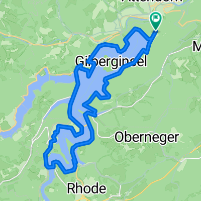
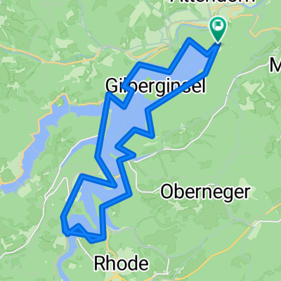
Rund um Attendorn
A cycling route starting in Attendorn, North Rhine-Westphalia, Germany.
Overview
About this route
Challenging route, with sections over 20% gradient/decline, approximately 2200 meters of elevation gain,
- -:--
- Duration
- 86.6 km
- Distance
- 1,205 m
- Ascent
- 1,205 m
- Descent
- ---
- Avg. speed
- ---
- Max. altitude
Route quality
Waytypes & surfaces along the route
Waytypes
Track
52.8 km
(61 %)
Quiet road
13 km
(15 %)
Surfaces
Paved
30.3 km
(35 %)
Unpaved
39.8 km
(46 %)
Asphalt
26.8 km
(31 %)
Gravel
19.1 km
(22 %)
Continue with Bikemap
Use, edit, or download this cycling route
You would like to ride Rund um Attendorn or customize it for your own trip? Here is what you can do with this Bikemap route:
Free features
- Save this route as favorite or in collections
- Copy & plan your own version of this route
- Split it into stages to create a multi-day tour
- Sync your route with Garmin or Wahoo
Premium features
Free trial for 3 days, or one-time payment. More about Bikemap Premium.
- Navigate this route on iOS & Android
- Export a GPX / KML file of this route
- Create your custom printout (try it for free)
- Download this route for offline navigation
Discover more Premium features.
Get Bikemap PremiumFrom our community
Other popular routes starting in Attendorn
 An der Kreisgrenze Olpe entlang - Teil 1 (West-Süd)
- Distance
- 103.9 km
- Ascent
- 1,194 m
- Descent
- 1,194 m
- Location
- Attendorn, North Rhine-Westphalia, Germany
 Anspruchsvolle Rennradstrecke
- Distance
- 92.8 km
- Ascent
- 1,350 m
- Descent
- 1,296 m
- Location
- Attendorn, North Rhine-Westphalia, Germany
 Rund um den Biggesee
- Distance
- 25.4 km
- Ascent
- 327 m
- Descent
- 327 m
- Location
- Attendorn, North Rhine-Westphalia, Germany
 Rund um den Biggesee
- Distance
- 50.8 km
- Ascent
- 331 m
- Descent
- 331 m
- Location
- Attendorn, North Rhine-Westphalia, Germany
 Rund um Attendorn
- Distance
- 86.6 km
- Ascent
- 1,205 m
- Descent
- 1,205 m
- Location
- Attendorn, North Rhine-Westphalia, Germany
 40er Nebenstrecken
- Distance
- 44.1 km
- Ascent
- 492 m
- Descent
- 492 m
- Location
- Attendorn, North Rhine-Westphalia, Germany
 Bike Arena Sauerland - Über den Rhein-Weser-Turm (Start: Olpe-Apollmicke)
- Distance
- 123.1 km
- Ascent
- 1,281 m
- Descent
- 1,290 m
- Location
- Attendorn, North Rhine-Westphalia, Germany
 MTB Att,Heldener Höhe, Borghausen, Jäckelchen, Biggerandweg, Att.
- Distance
- 42.5 km
- Ascent
- 651 m
- Descent
- 653 m
- Location
- Attendorn, North Rhine-Westphalia, Germany
Open it in the app