

MG Erfenschlag-Dittersdorfer Höhe-Kemtauer Felsen-Erfenschlag
A cycling route starting in Gornau, Saxony, Germany.
Overview
About this route
- -:--
- Duration
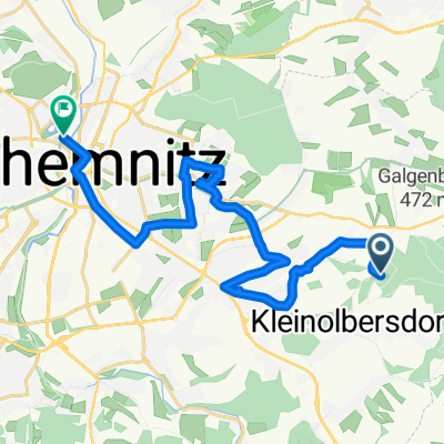
- 30.7 km
- Distance
- 523 m
- Ascent
- 523 m
- Descent
- ---
- Avg. speed
- ---
- Max. altitude

Continue with Bikemap
Use, edit, or download this cycling route
You would like to ride MG Erfenschlag-Dittersdorfer Höhe-Kemtauer Felsen-Erfenschlag or customize it for your own trip? Here is what you can do with this Bikemap route:
Free features
- Save this route as favorite or in collections
- Copy & plan your own version of this route
- Sync your route with Garmin or Wahoo
Premium features
Free trial for 3 days, or one-time payment. More about Bikemap Premium.
- Navigate this route on iOS & Android
- Export a GPX / KML file of this route
- Create your custom printout (try it for free)
- Download this route for offline navigation
Discover more Premium features.
Get Bikemap PremiumFrom our community
Other popular routes starting in Gornau
 MG Erfenschlag-Dittersdorfer Höhe-Kemtauer Felsen-Erfenschlag
- Distance
- 30.7 km
- Ascent
- 523 m
- Descent
- 523 m
- Location
- Gornau, Saxony, Germany
 Erz1
Erz1- Distance
- 41.9 km
- Ascent
- 819 m
- Descent
- 819 m
- Location
- Gornau, Saxony, Germany
 Gornau Pöhlberg und zurück
- Distance
- 80 km
- Ascent
- 986 m
- Descent
- 986 m
- Location
- Gornau, Saxony, Germany
 Route Ost
- Distance
- 17.6 km
- Ascent
- 90 m
- Descent
- 300 m
- Location
- Gornau, Saxony, Germany
 MG Erfenschlag Augustusburg Sternmühltal
- Distance
- 37.9 km
- Ascent
- 549 m
- Descent
- 549 m
- Location
- Gornau, Saxony, Germany
 Dittersdorf-Thalheim Spaß-Tour
- Distance
- 19.2 km
- Ascent
- 357 m
- Descent
- 323 m
- Location
- Gornau, Saxony, Germany
 Panoramatour und Planetenweg
- Distance
- 43.5 km
- Ascent
- 591 m
- Descent
- 591 m
- Location
- Gornau, Saxony, Germany
 leichte Einsiedler race streckemix
- Distance
- 5.3 km
- Ascent
- 165 m
- Descent
- 161 m
- Location
- Gornau, Saxony, Germany
Open it in the app