

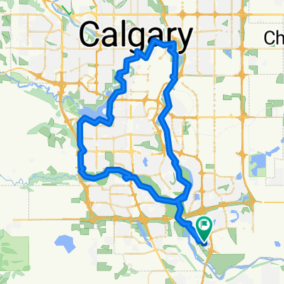
39 Legacy Path SE, Calgary to 818 Walden Dr SE, Calgary
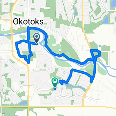
A cycling route starting in Okotoks, Alberta, Canada.
Overview
About this route
- 36 min
- Duration
- 5.5 km
- Distance
- 13 m
- Ascent
- 21 m
- Descent
- 9.1 km/h
- Avg. speed
- 1,050 m
- Max. altitude
Continue with Bikemap
Use, edit, or download this cycling route
You would like to ride 39 Legacy Path SE, Calgary to 818 Walden Dr SE, Calgary or customize it for your own trip? Here is what you can do with this Bikemap route:
Free features
- Save this route as favorite or in collections
- Copy & plan your own version of this route
- Sync your route with Garmin or Wahoo
Premium features
Free trial for 3 days, or one-time payment. More about Bikemap Premium.
- Navigate this route on iOS & Android
- Export a GPX / KML file of this route
- Create your custom printout (try it for free)
- Download this route for offline navigation
Discover more Premium features.
Get Bikemap PremiumFrom our community
Other popular routes starting in Okotoks
 Woodbend Way, Okotoks to Cimarron Park Cir, Okotoks
- Distance
- 9.5 km
- Ascent
- 48 m
- Descent
- 35 m
- Location
- Okotoks, Alberta, Canada
 circle 76
- Distance
- 76.7 km
- Ascent
- 2,629 m
- Descent
- 2,625 m
- Location
- Okotoks, Alberta, Canada
 Okotoks Bike Path Ride
- Distance
- 19.7 km
- Ascent
- 112 m
- Descent
- 110 m
- Location
- Okotoks, Alberta, Canada
 Okotoks Bike Path Ride
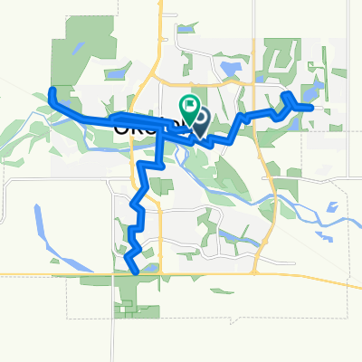
- Distance
- 35.1 km
- Ascent
- 149 m
- Descent
- 148 m
- Location
- Okotoks, Alberta, Canada
 Follow the Bow
- Distance
- 94.4 km
- Ascent
- 310 m
- Descent
- 308 m
- Location
- Okotoks, Alberta, Canada
 Sheep River Cove, Okotoks to Big Rock Ln, Okotoks
- Distance
- 10.3 km
- Ascent
- 59 m
- Descent
- 73 m
- Location
- Okotoks, Alberta, Canada
 45 Minute SE Loop
- Distance
- 13.6 km
- Ascent
- 17 m
- Descent
- 19 m
- Location
- Okotoks, Alberta, Canada
 35 Cranleigh Dr SE, Calgary to 80 Somervale Pk SW, Calgary
- Distance
- 9.4 km
- Ascent
- 52 m
- Descent
- 49 m
- Location
- Okotoks, Alberta, Canada
Open it in the app