

Dörfer - Runde
A cycling route starting in Rheinbach, North Rhine-Westphalia, Germany.
Overview
About this route
- 1 h 5 min
- Duration
- 19.1 km
- Distance
- 97 m
- Ascent
- 149 m
- Descent
- 17.7 km/h
- Avg. speed
- 204 m
- Max. altitude

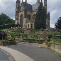
Route photos


Route quality
Waytypes & surfaces along the route
Waytypes
Quiet road
6.1 km
(32 %)
Path
4 km
(21 %)
Surfaces
Paved
17.6 km
(92 %)
Unpaved
0.4 km
(2 %)
Asphalt
17.6 km
(92 %)
Gravel
0.4 km
(2 %)
Undefined
1.1 km
(6 %)
Continue with Bikemap
Use, edit, or download this cycling route
You would like to ride Dörfer - Runde or customize it for your own trip? Here is what you can do with this Bikemap route:
Free features
- Save this route as favorite or in collections
- Copy & plan your own version of this route
- Sync your route with Garmin or Wahoo
Premium features
Free trial for 3 days, or one-time payment. More about Bikemap Premium.
- Navigate this route on iOS & Android
- Export a GPX / KML file of this route
- Create your custom printout (try it for free)
- Download this route for offline navigation
Discover more Premium features.
Get Bikemap PremiumFrom our community
Other popular routes starting in Rheinbach
 Siebengebirge, Oelberg, Linz, Remagen
- Distance
- 90.4 km
- Ascent
- 951 m
- Descent
- 1,004 m
- Location
- Rheinbach, North Rhine-Westphalia, Germany
 Leichte Rundfahrt nördlich von Rheinbach
- Distance
- 15.7 km
- Ascent
- 37 m
- Descent
- 37 m
- Location
- Rheinbach, North Rhine-Westphalia, Germany
 Zur Siegfähre Teil 1
- Distance
- 25.1 km
- Ascent
- 223 m
- Descent
- 375 m
- Location
- Rheinbach, North Rhine-Westphalia, Germany
 Sonntags zur Ahr uz
- Distance
- 89.2 km
- Ascent
- 966 m
- Descent
- 963 m
- Location
- Rheinbach, North Rhine-Westphalia, Germany
 Eifel Große Runde
- Distance
- 61.2 km
- Ascent
- 517 m
- Descent
- 570 m
- Location
- Rheinbach, North Rhine-Westphalia, Germany
 Große Eifel Runde Rheinbach
- Distance
- 143.6 km
- Ascent
- 2,239 m
- Descent
- 2,096 m
- Location
- Rheinbach, North Rhine-Westphalia, Germany
 Vischeltal, Ahrtal
- Distance
- 60.4 km
- Ascent
- 857 m
- Descent
- 883 m
- Location
- Rheinbach, North Rhine-Westphalia, Germany
 Lind (Eifel)
- Distance
- 56.4 km
- Ascent
- 1,075 m
- Descent
- 1,054 m
- Location
- Rheinbach, North Rhine-Westphalia, Germany
Open it in the app