
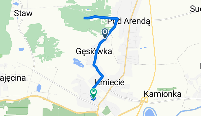
Jasionka 542, Trzebownisko do Jasionka 215, Trzebownisko
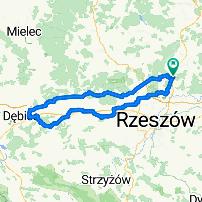
A cycling route starting in Wysoka Głogowska, Subcarpathian Voivodeship, Poland.
Overview
About this route
- 29 min
- Duration
- 6.2 km
- Distance
- 63 m
- Ascent
- 46 m
- Descent
- 12.9 km/h
- Avg. speed
- 231 m
- Max. altitude
Continue with Bikemap
Use, edit, or download this cycling route
You would like to ride Jasionka 542, Trzebownisko do Jasionka 215, Trzebownisko or customize it for your own trip? Here is what you can do with this Bikemap route:
Free features
- Save this route as favorite or in collections
- Copy & plan your own version of this route
- Sync your route with Garmin or Wahoo
Premium features
Free trial for 3 days, or one-time payment. More about Bikemap Premium.
- Navigate this route on iOS & Android
- Export a GPX / KML file of this route
- Create your custom printout (try it for free)
- Download this route for offline navigation
Discover more Premium features.
Get Bikemap PremiumFrom our community
Other popular routes starting in Wysoka Głogowska
 dębica i druga stobierna WERSJA GOTOWA 121km ZYDSON EDITION
- Distance
- 123.9 km
- Ascent
- 357 m
- Descent
- 358 m
- Location
- Wysoka Głogowska, Subcarpathian Voivodeship, Poland
 jeszcze szybsza dzida do jeziorka
- Distance
- 10 km
- Ascent
- 88 m
- Descent
- 60 m
- Location
- Wysoka Głogowska, Subcarpathian Voivodeship, Poland
 3 pogwizodwy wersja poprawiona przez ojca
- Distance
- 80.6 km
- Ascent
- 219 m
- Descent
- 217 m
- Location
- Wysoka Głogowska, Subcarpathian Voivodeship, Poland
 MTU - Cyziówka
- Distance
- 28.9 km
- Ascent
- 123 m
- Descent
- 104 m
- Location
- Wysoka Głogowska, Subcarpathian Voivodeship, Poland
 terenowa 50
- Distance
- 49 km
- Ascent
- 357 m
- Descent
- 361 m
- Location
- Wysoka Głogowska, Subcarpathian Voivodeship, Poland
 kozak pentla 2 huciska i lowisko pogorzalka
- Distance
- 101 km
- Ascent
- 249 m
- Descent
- 250 m
- Location
- Wysoka Głogowska, Subcarpathian Voivodeship, Poland
 pacanow
- Distance
- 198.7 km
- Ascent
- 326 m
- Descent
- 324 m
- Location
- Wysoka Głogowska, Subcarpathian Voivodeship, Poland
 stobierna-ulanowgrubasamichaladomina-stalowawola-USA
- Distance
- 127.9 km
- Ascent
- 243 m
- Descent
- 243 m
- Location
- Wysoka Głogowska, Subcarpathian Voivodeship, Poland
Open it in the app