![화도읍 409-1, 남양주시Ph0]으로 라우팅](/_next/static/media/contour-lines-light-small.cafd5e5d.avif)
![화도읍 409-1, 남양주시Ph0]으로 라우팅](https://media.bikemap.net/routes/13406380/staticmaps/in_f4a0ac81-32f3-4a79-966e-4491e1dcf12f_694x400_bikemap-2021-3D-static.png)
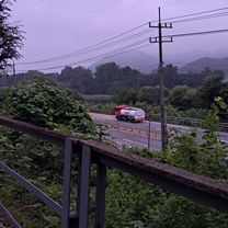
화도읍 409-1, 남양주시Ph0]으로 라우팅
A cycling route starting in Hwado, Gyeonggi-do, South Korea.
Overview
About this route
- 47 min
- Duration
- 5.1 km
- Distance
- 13 m
- Ascent
- 53 m
- Descent
- 6.5 km/h
- Avg. speed
- 76 m
- Max. altitude
Continue with Bikemap
Use, edit, or download this cycling route
You would like to ride 화도읍 409-1, 남양주시Ph0]으로 라우팅 or customize it for your own trip? Here is what you can do with this Bikemap route:
Free features
- Save this route as favorite or in collections
- Copy & plan your own version of this route
- Sync your route with Garmin or Wahoo
Premium features
Free trial for 3 days, or one-time payment. More about Bikemap Premium.
- Navigate this route on iOS & Android
- Export a GPX / KML file of this route
- Create your custom printout (try it for free)
- Download this route for offline navigation
Discover more Premium features.
Get Bikemap PremiumFrom our community
Other popular routes starting in Hwado
 조안면 285-5 ~ 조안면 228-2
- Distance
- 5 km
- Ascent
- 11 m
- Descent
- 37 m
- Location
- Hwado, Gyeonggi-do, South Korea
 서종 라이딩
- Distance
- 6.1 km
- Ascent
- 177 m
- Descent
- 108 m
- Location
- Hwado, Gyeonggi-do, South Korea
 조안면 ~ 조안면 227-3
- Distance
- 4.9 km
- Ascent
- 0 m
- Descent
- 14 m
- Location
- Hwado, Gyeonggi-do, South Korea
 조안면 17-9 ~ 양서면 480-4
- Distance
- 12.8 km
- Ascent
- 32 m
- Descent
- 65 m
- Location
- Hwado, Gyeonggi-do, South Korea
 2025.8.27 삼봉리-국수리 라이딩
- Distance
- 16.4 km
- Ascent
- 79 m
- Descent
- 98 m
- Location
- Hwado, Gyeonggi-do, South Korea
 조안면 285-5 ~ 조안면 285-6
- Distance
- 10.1 km
- Ascent
- 0 m
- Descent
- 12 m
- Location
- Hwado, Gyeonggi-do, South Korea
![Ph0]에서 경로조안면 285-1](https://media.bikemap.net/routes/17452380/gallery/thumbs/d5a8e81a-206c-408c-9f1e-5a6e50deaf31.jpg.208x208_q80_crop.jpg) Ph0]에서 경로조안면 285-1
Ph0]에서 경로조안면 285-1- Distance
- 7 km
- Ascent
- 19 m
- Descent
- 50 m
- Location
- Hwado, Gyeonggi-do, South Korea
 화도읍 33−1, 남양주시 to 가운동, 남양주시
- Distance
- 18.9 km
- Ascent
- 287 m
- Descent
- 353 m
- Location
- Hwado, Gyeonggi-do, South Korea
Open it in the app