

Official St. Marys - Celina Route
A cycling route starting in Saint Marys, Ohio, United States.
Overview
About this route
This is the official bike route between St. Marys and Celina. There is bike lane most of the way, but it is unprotected and cars travel at high speeds, so be especially cautious. This route is not recommended for bicyclists uncomfortable with riding with high speed traffic.
- -:--
- Duration
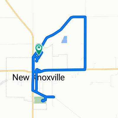
- 14.3 km
- Distance
- 27 m
- Ascent
- 32 m
- Descent
- ---
- Avg. speed
- 275 m
- Max. altitude
Route quality
Waytypes & surfaces along the route
Waytypes
Quiet road
4.7 km
(33 %)
Cycleway
0.6 km
(4 %)
Surfaces
Paved
0.6 km
(4 %)
Asphalt
0.6 km
(4 %)
Undefined
13.8 km
(96 %)
Route highlights
Points of interest along the route
Point of interest after 2 km
An old railroad track is visible in the grass here.
Point of interest after 3.7 km
There used to be a well here, but it was removed not too long ago. The old pavement and rubble is still visible.
Point of interest after 7.3 km
This is an old drive-in movie theater. Although it has long since closed, many of the original elements still remain.
Continue with Bikemap
Use, edit, or download this cycling route
You would like to ride Official St. Marys - Celina Route or customize it for your own trip? Here is what you can do with this Bikemap route:
Free features
- Save this route as favorite or in collections
- Copy & plan your own version of this route
- Sync your route with Garmin or Wahoo
Premium features
Free trial for 3 days, or one-time payment. More about Bikemap Premium.
- Navigate this route on iOS & Android
- Export a GPX / KML file of this route
- Create your custom printout (try it for free)
- Download this route for offline navigation
Discover more Premium features.
Get Bikemap PremiumFrom our community
Other popular routes starting in Saint Marys
 St. Marys to Westerville
- Distance
- 178.7 km
- Ascent
- 416 m
- Descent
- 404 m
- Location
- Saint Marys, Ohio, United States
 Downtown to Memorial High School via NYC
- Distance
- 2.7 km
- Ascent
- 8 m
- Descent
- 4 m
- Location
- Saint Marys, Ohio, United States
 St. Marys Miami Erie Canal Trail
- Distance
- 4 km
- Ascent
- 4 m
- Descent
- 4 m
- Location
- Saint Marys, Ohio, United States
 Downtown to Grand Lake St. Marys
- Distance
- 3.4 km
- Ascent
- 12 m
- Descent
- 4 m
- Location
- Saint Marys, Ohio, United States
 Slow ride in Saint Marys
- Distance
- 1 km
- Ascent
- 0 m
- Descent
- 0 m
- Location
- Saint Marys, Ohio, United States
 St. Marys to Minster via Miami Erie Canal
- Distance
- 16.7 km
- Ascent
- 44 m
- Descent
- 14 m
- Location
- Saint Marys, Ohio, United States
 106 Saxony Dr, New Knoxville to 106 Saxony Dr, New Knoxville
- Distance
- 11.7 km
- Ascent
- 13 m
- Descent
- 13 m
- Location
- Saint Marys, Ohio, United States
 St. Marys Memorial High School Path
- Distance
- 0.7 km
- Ascent
- 0 m
- Descent
- 0 m
- Location
- Saint Marys, Ohio, United States
Open it in the app