Downtown to Grand Lake St. Marys
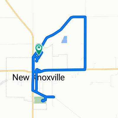
A cycling route starting in Saint Marys, Ohio, United States of America.
Overview
About this route
This route takes you from downtown St. Marys to Grand Lake St. Marys while avoiding traffic on Celina Road.
- -:--
- Duration
- 3.4 km
- Distance
- 12 m
- Ascent
- 4 m
- Descent
- ---
- Avg. speed
- 275 m
- Avg. speed
Route quality
Waytypes & surfaces along the route
Waytypes
Quiet road
2.6 km
(77 %)
Cycleway
0.4 km
(11 %)
Surfaces
Paved
0.4 km
(10 %)
Asphalt
0.4 km
(10 %)
Undefined
3.1 km
(90 %)
Continue with Bikemap
Use, edit, or download this cycling route
You would like to ride Downtown to Grand Lake St. Marys or customize it for your own trip? Here is what you can do with this Bikemap route:
Free features
- Save this route as favorite or in collections
- Copy & plan your own version of this route
- Sync your route with Garmin or Wahoo
Premium features
Free trial for 3 days, or one-time payment. More about Bikemap Premium.
- Navigate this route on iOS & Android
- Export a GPX / KML file of this route
- Create your custom printout (try it for free)
- Download this route for offline navigation
Discover more Premium features.
Get Bikemap PremiumFrom our community
Other popular routes starting in Saint Marys
- Downtown to Memorial High School via NYC
- Distance
- 2.7 km
- Ascent
- 8 m
- Descent
- 4 m
- Location
- Saint Marys, Ohio, United States of America
- Downtown to Grand Lake St. Marys
- Distance
- 3.4 km
- Ascent
- 12 m
- Descent
- 4 m
- Location
- Saint Marys, Ohio, United States of America
- Slow ride in Saint Marys
- Distance
- 3.2 km
- Ascent
- 59 m
- Descent
- 53 m
- Location
- Saint Marys, Ohio, United States of America
- Slow ride in Saint Marys
- Distance
- 1 km
- Ascent
- 0 m
- Descent
- 0 m
- Location
- Saint Marys, Ohio, United States of America
- St. Marys Miami Erie Canal Trail
- Distance
- 4 km
- Ascent
- 4 m
- Descent
- 4 m
- Location
- Saint Marys, Ohio, United States of America
- St. Marys Memorial High School Path
- Distance
- 0.7 km
- Ascent
- 0 m
- Descent
- 0 m
- Location
- Saint Marys, Ohio, United States of America
- St. Marys to Westerville
- Distance
- 178.7 km
- Ascent
- 416 m
- Descent
- 404 m
- Location
- Saint Marys, Ohio, United States of America
- St. Marys to Minster via Miami Erie Canal
- Distance
- 16.7 km
- Ascent
- 44 m
- Descent
- 14 m
- Location
- Saint Marys, Ohio, United States of America
Open it in the app