

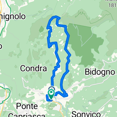
Tesserete - Rifugio Monte Bar - San Lucio - Tesserete
A cycling route starting in Tesserete, Canton Ticino, Switzerland.
Overview
About this route
- -:--
- Duration
- 40.4 km
- Distance
- 1,180 m
- Ascent
- 1,180 m
- Descent
- ---
- Avg. speed
- ---
- Max. altitude
Continue with Bikemap
Use, edit, or download this cycling route
You would like to ride Tesserete - Rifugio Monte Bar - San Lucio - Tesserete or customize it for your own trip? Here is what you can do with this Bikemap route:
Free features
- Save this route as favorite or in collections
- Copy & plan your own version of this route
- Sync your route with Garmin or Wahoo
Premium features
Free trial for 3 days, or one-time payment. More about Bikemap Premium.
- Navigate this route on iOS & Android
- Export a GPX / KML file of this route
- Create your custom printout (try it for free)
- Download this route for offline navigation
Discover more Premium features.
Get Bikemap PremiumFrom our community
Other popular routes starting in Tesserete
 Tesserete-GolaDiLago-Tesserete
- Distance
- 14.7 km
- Ascent
- 540 m
- Descent
- 537 m
- Location
- Tesserete, Canton Ticino, Switzerland
 Scenic Trail 2024 - Scenic Trail 2024 - K54 - Scenic Trail 2024 - Scenic Trail 2024 - K54 sur TraceDeTrail.fr
- Distance
- 54.7 km
- Ascent
- 4,778 m
- Descent
- 4,755 m
- Location
- Tesserete, Canton Ticino, Switzerland
 Montebar-4756
- Distance
- 39.9 km
- Ascent
- 1,401 m
- Descent
- 1,389 m
- Location
- Tesserete, Canton Ticino, Switzerland
 Tesserete - Rifugio Monte Bar - San Lucio - Tesserete
- Distance
- 40.4 km
- Ascent
- 1,180 m
- Descent
- 1,180 m
- Location
- Tesserete, Canton Ticino, Switzerland
 Capriasca, Monte Bar, Rifugio San Lucio, Capriasca
- Distance
- 40.7 km
- Ascent
- 1,193 m
- Descent
- 1,193 m
- Location
- Tesserete, Canton Ticino, Switzerland
 Tesserete-GolaDiLago-Trail-Expedition
- Distance
- 13.9 km
- Ascent
- 544 m
- Descent
- 544 m
- Location
- Tesserete, Canton Ticino, Switzerland
 Monte Bar
- Distance
- 48.5 km
- Ascent
- 1,814 m
- Descent
- 1,814 m
- Location
- Tesserete, Canton Ticino, Switzerland
 Tesserete - Gola di Lago - Monte Bar - Piandanazzo - San Lucio - Tesserete
- Distance
- 39.2 km
- Ascent
- 1,280 m
- Descent
- 1,276 m
- Location
- Tesserete, Canton Ticino, Switzerland
Open it in the app