

Sukabumi-Pondok Halimun-Selabintana
A cycling route starting in Sukabumi, West Java, Indonesia.
Overview
About this route
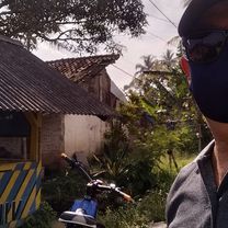
A truely XC uphill from Sukabumi to Pondok Halimun area (Goalpara Tea Plantation)
- -:--
- Duration
- 31.5 km
- Distance
- 695 m
- Ascent
- 695 m
- Descent
- ---
- Avg. speed
- ---
- Max. altitude

Continue with Bikemap
Use, edit, or download this cycling route
You would like to ride Sukabumi-Pondok Halimun-Selabintana or customize it for your own trip? Here is what you can do with this Bikemap route:
Free features
- Save this route as favorite or in collections
- Copy & plan your own version of this route
- Sync your route with Garmin or Wahoo
Premium features
Free trial for 3 days, or one-time payment. More about Bikemap Premium.
- Navigate this route on iOS & Android
- Export a GPX / KML file of this route
- Create your custom printout (try it for free)
- Download this route for offline navigation
Discover more Premium features.
Get Bikemap PremiumFrom our community
Other popular routes starting in Sukabumi
 3V9H+5RG, Kecamatan Gunung Guruh to Jalan Perum Mangkalaya 1, Kecamatan Gunung Guruh
- Distance
- 23.5 km
- Ascent
- 553 m
- Descent
- 553 m
- Location
- Sukabumi, West Java, Indonesia
 Sukabumi Situ Gunung (plan)
- Distance
- 23.2 km
- Ascent
- 559 m
- Descent
- 559 m
- Location
- Sukabumi, West Java, Indonesia
 Sudajaya Hilir, Kecamatan Baros to Jalan Widyakrama 16, Kecamatan Baros
- Distance
- 33.5 km
- Ascent
- 491 m
- Descent
- 488 m
- Location
- Sukabumi, West Java, Indonesia
 3V9H+5RG, Kecamatan Gunung Guruh to Jalan Cipanengah Girang, Kecamatan Warudoyong
- Distance
- 7.8 km
- Ascent
- 335 m
- Descent
- 419 m
- Location
- Sukabumi, West Java, Indonesia
 2nd route
- Distance
- 14.3 km
- Ascent
- 554 m
- Descent
- 420 m
- Location
- Sukabumi, West Java, Indonesia
 puncak pondok halimun sukabumi gunung pangrango
- Distance
- 31.9 km
- Ascent
- 753 m
- Descent
- 752 m
- Location
- Sukabumi, West Java, Indonesia
 Jalan Lingkar Selatan 10, Kecamatan Warudoyong to Jalan Rasamala Raya 21, Kecamatan Cisaat
- Distance
- 3.3 km
- Ascent
- 279 m
- Descent
- 219 m
- Location
- Sukabumi, West Java, Indonesia
 Jalan Tanjung 40, Kecamatan Sukabumi to Jalan Raya Cisaat 208, Kecamatan Cisaat
- Distance
- 14 km
- Ascent
- 162 m
- Descent
- 71 m
- Location
- Sukabumi, West Java, Indonesia
Open it in the app