

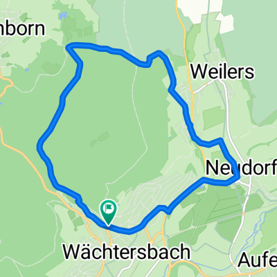
Südbahnradweg und Apfelweinroute
A cycling route starting in Wächtersbach, Hesse, Germany.
Overview
About this route
very varied route on bike paths and low-traffic streets
- -:--
- Duration
- 49.5 km
- Distance
- 491 m
- Ascent
- 491 m
- Descent
- ---
- Avg. speed
- 383 m
- Max. altitude

Route photos


Route quality
Waytypes & surfaces along the route
Waytypes
Track
21.8 km
(44 %)
Road
7.9 km
(16 %)
Surfaces
Paved
36.6 km
(74 %)
Unpaved
5.9 km
(12 %)
Asphalt
36.1 km
(73 %)
Gravel
5.9 km
(12 %)
Continue with Bikemap
Use, edit, or download this cycling route
You would like to ride Südbahnradweg und Apfelweinroute or customize it for your own trip? Here is what you can do with this Bikemap route:
Free features
- Save this route as favorite or in collections
- Copy & plan your own version of this route
- Sync your route with Garmin or Wahoo
Premium features
Free trial for 3 days, or one-time payment. More about Bikemap Premium.
- Navigate this route on iOS & Android
- Export a GPX / KML file of this route
- Create your custom printout (try it for free)
- Download this route for offline navigation
Discover more Premium features.
Get Bikemap PremiumFrom our community
Other popular routes starting in Wächtersbach
 Wächtersbach - Wittgenborn (kleine Runde)
- Distance
- 10 km
- Ascent
- 213 m
- Descent
- 226 m
- Location
- Wächtersbach, Hesse, Germany
 Spessart-Wald-Runde
- Distance
- 41 km
- Ascent
- 625 m
- Descent
- 415 m
- Location
- Wächtersbach, Hesse, Germany
 Wächtersbach - Stausee
- Distance
- 30.3 km
- Ascent
- 162 m
- Descent
- 163 m
- Location
- Wächtersbach, Hesse, Germany
 Gründau Wächtersbach
- Distance
- 21 km
- Ascent
- 164 m
- Descent
- 172 m
- Location
- Wächtersbach, Hesse, Germany
 Auf-Schlier-Hellst-Udenh-Kätwill-BSS-Auf
- Distance
- 25.9 km
- Ascent
- 219 m
- Descent
- 217 m
- Location
- Wächtersbach, Hesse, Germany
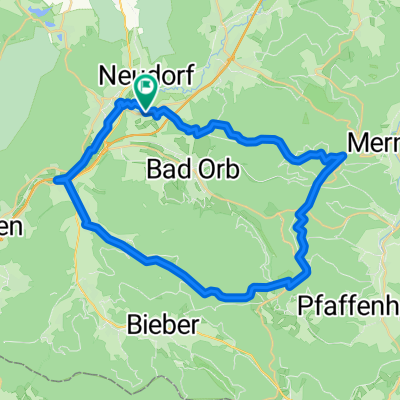
 Pfingstrunde-Aufenau-Obermoos-Radmühl-Aufenau
- Distance
- 72 km
- Ascent
- 471 m
- Descent
- 470 m
- Location
- Wächtersbach, Hesse, Germany
 1997 Wächtersbach-Wern Tal
- Distance
- 77.3 km
- Ascent
- 552 m
- Descent
- 525 m
- Location
- Wächtersbach, Hesse, Germany
 Wächtersbach - Lütter (Eichenzell)
- Distance
- 54.6 km
- Ascent
- 426 m
- Descent
- 257 m
- Location
- Wächtersbach, Hesse, Germany
Open it in the app