
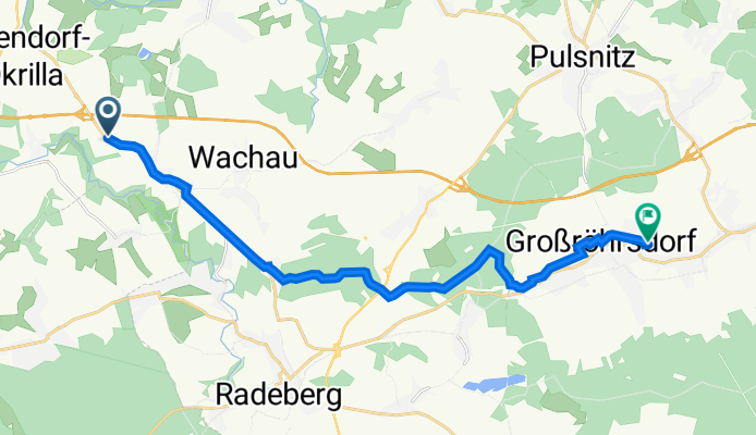
Tina-von-Brühl-Straße, Wachau nach Breitscheidstraße 11, Großröhrsdorf
A cycling route starting in Wachau, Saxony, Germany.
Overview
About this route
- 46 min
- Duration
- 15.5 km
- Distance
- 154 m
- Ascent
- 130 m
- Descent
- 20.1 km/h
- Avg. speed
- 295 m
- Max. altitude

Route quality
Waytypes & surfaces along the route
Waytypes
Quiet road
6.2 km
(40 %)
Track
5.5 km
(36 %)
Surfaces
Paved
7 km
(45 %)
Unpaved
5.5 km
(35 %)
Asphalt
6.9 km
(44 %)
Gravel
3 km
(20 %)
Continue with Bikemap
Use, edit, or download this cycling route
You would like to ride Tina-von-Brühl-Straße, Wachau nach Breitscheidstraße 11, Großröhrsdorf or customize it for your own trip? Here is what you can do with this Bikemap route:
Free features
- Save this route as favorite or in collections
- Copy & plan your own version of this route
- Sync your route with Garmin or Wahoo
Premium features
Free trial for 3 days, or one-time payment. More about Bikemap Premium.
- Navigate this route on iOS & Android
- Export a GPX / KML file of this route
- Create your custom printout (try it for free)
- Download this route for offline navigation
Discover more Premium features.
Get Bikemap PremiumFrom our community
Other popular routes starting in Wachau
 Lausitzer Runde 1
- Distance
- 128.8 km
- Ascent
- 521 m
- Descent
- 520 m
- Location
- Wachau, Saxony, Germany
 Schnelle Ausspanne Seifersdorf- Lausnitzer Heide
- Distance
- 32.3 km
- Ascent
- 199 m
- Descent
- 198 m
- Location
- Wachau, Saxony, Germany
 10. ENSO-RUNDUM-TOUR 2012
- Distance
- 33 km
- Ascent
- 224 m
- Descent
- 222 m
- Location
- Wachau, Saxony, Germany
 Seifersdorf
- Distance
- 26.1 km
- Ascent
- 229 m
- Descent
- 228 m
- Location
- Wachau, Saxony, Germany
 Moritzburger Runde
- Distance
- 48.9 km
- Ascent
- 245 m
- Descent
- 245 m
- Location
- Wachau, Saxony, Germany
 Kulturroute Westlausitz
- Distance
- 91.1 km
- Ascent
- 1,098 m
- Descent
- 993 m
- Location
- Wachau, Saxony, Germany
 Test Seifersdorf - Knappensee V1
- Distance
- 54.6 km
- Ascent
- 166 m
- Descent
- 261 m
- Location
- Wachau, Saxony, Germany
 Nachmittagsrunde
- Distance
- 74 km
- Ascent
- 429 m
- Descent
- 429 m
- Location
- Wachau, Saxony, Germany
Open it in the app