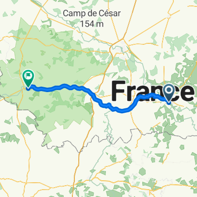
La Châtre nach Saint-Amand-Montrond
A cycling route starting in La Châtre, Centre Region, France.
Overview
About this route
- 3 h 43 min
- Duration
- 59.2 km
- Distance
- 419 m
- Ascent
- 483 m
- Descent
- 15.9 km/h
- Avg. speed
- 286 m
- Avg. speed
Route quality
Waytypes & surfaces along the route
Waytypes
Quiet road
29.1 km
(49 %)
Busy road
15.4 km
(26 %)
Surfaces
Paved
32.7 km
(55 %)
Asphalt
32.5 km
(55 %)
Paving stones
0.1 km
(<1 %)
Undefined
26.6 km
(45 %)
Continue with Bikemap
Use, edit, or download this cycling route
You would like to ride La Châtre nach Saint-Amand-Montrond or customize it for your own trip? Here is what you can do with this Bikemap route:
Free features
- Save this route as favorite or in collections
- Copy & plan your own version of this route
- Sync your route with Garmin or Wahoo
Premium features
Free trial for 3 days, or one-time payment. More about Bikemap Premium.
- Navigate this route on iOS & Android
- Export a GPX / KML file of this route
- Create your custom printout (try it for free)
- Download this route for offline navigation
Discover more Premium features.
Get Bikemap PremiumFrom our community
Other popular routes starting in La Châtre
- La Chatre EZF
- Distance
- 51.9 km
- Ascent
- 555 m
- Descent
- 535 m
- Location
- La Châtre, Centre Region, France
- La Châtre nach Saint-Amand-Montrond
- Distance
- 60.1 km
- Ascent
- 419 m
- Descent
- 489 m
- Location
- La Châtre, Centre Region, France
- bourboule
- Distance
- 189.3 km
- Ascent
- 3,241 m
- Descent
- 2,608 m
- Location
- La Châtre, Centre Region, France
- 6-Langs Oude Wegen
- Distance
- 210.5 km
- Ascent
- 3,070 m
- Descent
- 2,937 m
- Location
- La Châtre, Centre Region, France
- La Châtre nach Cours Manuel 42, Saint-Amand-Montrond
- Distance
- 59.8 km
- Ascent
- 415 m
- Descent
- 480 m
- Location
- La Châtre, Centre Region, France
- La Châtre nach Saint-Amand-Montrond
- Distance
- 59.2 km
- Ascent
- 419 m
- Descent
- 483 m
- Location
- La Châtre, Centre Region, France
- La Chatre-Roanne
- Distance
- 192.7 km
- Ascent
- 1,160 m
- Descent
- 1,034 m
- Location
- La Châtre, Centre Region, France
- Le Magny lac Eguzon
- Distance
- 89.8 km
- Ascent
- 690 m
- Descent
- 697 m
- Location
- La Châtre, Centre Region, France
Open it in the app