

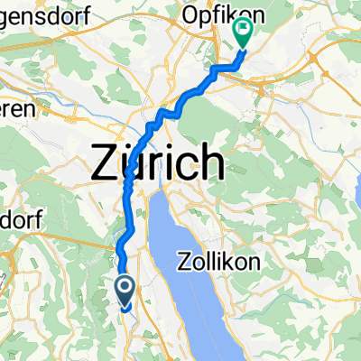
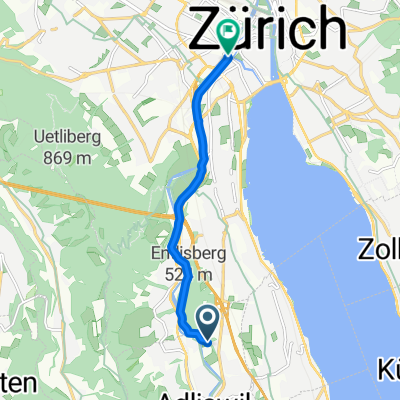
Soodstrasse 52, Adliswil nach Feldblumenstrasse 52, Zürich
A cycling route starting in Adliswil / Sood, Canton of Zurich, Switzerland.
Overview
About this route
- 35 min
- Duration
- 10.3 km
- Distance
- 56 m
- Ascent
- 80 m
- Descent
- 17.8 km/h
- Avg. speed
- 455 m
- Max. altitude

Route quality
Waytypes & surfaces along the route
Waytypes
Quiet road
3.3 km
(32 %)
Road
2.3 km
(23 %)
Surfaces
Paved
10 km
(97 %)
Unpaved
0.3 km
(3 %)
Asphalt
10 km
(97 %)
Loose gravel
0.3 km
(3 %)
Continue with Bikemap
Use, edit, or download this cycling route
You would like to ride Soodstrasse 52, Adliswil nach Feldblumenstrasse 52, Zürich or customize it for your own trip? Here is what you can do with this Bikemap route:
Free features
- Save this route as favorite or in collections
- Copy & plan your own version of this route
- Sync your route with Garmin or Wahoo
Premium features
Free trial for 3 days, or one-time payment. More about Bikemap Premium.
- Navigate this route on iOS & Android
- Export a GPX / KML file of this route
- Create your custom printout (try it for free)
- Download this route for offline navigation
Discover more Premium features.
Get Bikemap PremiumFrom our community
Other popular routes starting in Adliswil / Sood
 Soodstrasse 52, Adliswil nach Waldhofstrasse 27, Hittnau
- Distance
- 47.8 km
- Ascent
- 412 m
- Descent
- 150 m
- Location
- Adliswil / Sood, Canton of Zurich, Switzerland
 Zurich-Geneva
- Distance
- 279.8 km
- Ascent
- 1,584 m
- Descent
- 1,663 m
- Location
- Adliswil / Sood, Canton of Zurich, Switzerland
 Soodmattenstrasse 10, Adliswil nach Bleicherweg 37–47, Zürich
- Distance
- 6.1 km
- Ascent
- 86 m
- Descent
- 93 m
- Location
- Adliswil / Sood, Canton of Zurich, Switzerland
 Soodring, Adliswil nach Pfadhagstrasse, Wallisellen
- Distance
- 16.1 km
- Ascent
- 188 m
- Descent
- 166 m
- Location
- Adliswil / Sood, Canton of Zurich, Switzerland
 Soodstrasse 52, Adliswil nach Feldblumenstrasse 52, Zürich
- Distance
- 10.3 km
- Ascent
- 56 m
- Descent
- 80 m
- Location
- Adliswil / Sood, Canton of Zurich, Switzerland
 CH-Mitte/Voralpen: Adliswil - Albis - Ägerisee - Schwyz - Ibergeregg - Einsiedeln - Hirzel - Adliswil
- Distance
- 117.1 km
- Ascent
- 1,548 m
- Descent
- 1,545 m
- Location
- Adliswil / Sood, Canton of Zurich, Switzerland
 De Zürichstrasse 77F, Adliswil a Stauffacherbrücke, Zürich
- Distance
- 6.3 km
- Ascent
- 83 m
- Descent
- 123 m
- Location
- Adliswil / Sood, Canton of Zurich, Switzerland
 Zürichstrasse 62, Adliswil to Zürichstrasse 62, Adliswil
- Distance
- 3.4 km
- Ascent
- 28 m
- Descent
- 26 m
- Location
- Adliswil / Sood, Canton of Zurich, Switzerland
Open it in the app