

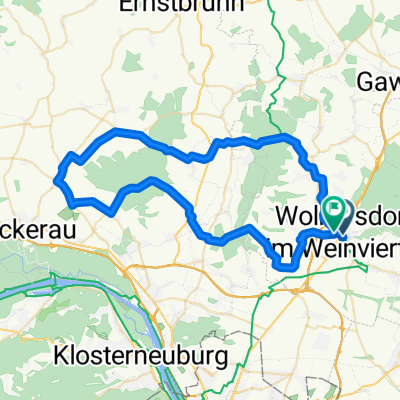
Kreuttal Berger
A cycling route starting in Wolkersdorf im Weinviertel, Lower Austria, Austria.
Overview
About this route
- -:--
- Duration
- 40.4 km
- Distance
- 284 m
- Ascent
- 288 m
- Descent
- ---
- Avg. speed
- 287 m
- Max. altitude
Route quality
Waytypes & surfaces along the route
Waytypes
Quiet road
12.1 km
(30 %)
Track
8.9 km
(22 %)
Surfaces
Paved
28.7 km
(71 %)
Unpaved
3.2 km
(8 %)
Asphalt
26.7 km
(66 %)
Gravel
3.2 km
(8 %)
Continue with Bikemap
Use, edit, or download this cycling route
You would like to ride Kreuttal Berger or customize it for your own trip? Here is what you can do with this Bikemap route:
Free features
- Save this route as favorite or in collections
- Copy & plan your own version of this route
- Sync your route with Garmin or Wahoo
Premium features
Free trial for 3 days, or one-time payment. More about Bikemap Premium.
- Navigate this route on iOS & Android
- Export a GPX / KML file of this route
- Create your custom printout (try it for free)
- Download this route for offline navigation
Discover more Premium features.
Get Bikemap PremiumFrom our community
Other popular routes starting in Wolkersdorf im Weinviertel
 Obersdorf - Triest
- Distance
- 628.8 km
- Ascent
- 6,679 m
- Descent
- 6,836 m
- Location
- Wolkersdorf im Weinviertel, Lower Austria, Austria
 pillichsdorf engersdorf
- Distance
- 15.8 km
- Ascent
- 92 m
- Descent
- 92 m
- Location
- Wolkersdorf im Weinviertel, Lower Austria, Austria
 Wienerwaldrunde inkl. Sophienalpe
- Distance
- 95.3 km
- Ascent
- 1,345 m
- Descent
- 1,354 m
- Location
- Wolkersdorf im Weinviertel, Lower Austria, Austria
 Wolkersdorf - Energieweg Gravel - Deutsch Wagram WindGraveln - Marchfeldkanal
- Distance
- 31.4 km
- Ascent
- 107 m
- Descent
- 125 m
- Location
- Wolkersdorf im Weinviertel, Lower Austria, Austria
 Energieweg Gravel: Wolkersdorf-Gänserndorf
- Distance
- 24.1 km
- Ascent
- 112 m
- Descent
- 182 m
- Location
- Wolkersdorf im Weinviertel, Lower Austria, Austria
 Rohrwald - Leitzersdorf -Kreuttal
- Distance
- 59.1 km
- Ascent
- 762 m
- Descent
- 758 m
- Location
- Wolkersdorf im Weinviertel, Lower Austria, Austria
 Untere Hofgärten, Wolkersdorf im Weinviertel nach Untere Hofgärten, Wolkersdorf im Weinviertel
- Distance
- 6.3 km
- Ascent
- 37 m
- Descent
- 37 m
- Location
- Wolkersdorf im Weinviertel, Lower Austria, Austria
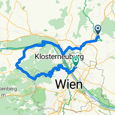
 Kahlenberg + Buschberg
- Distance
- 119.1 km
- Ascent
- 1,454 m
- Descent
- 1,446 m
- Location
- Wolkersdorf im Weinviertel, Lower Austria, Austria
Open it in the app