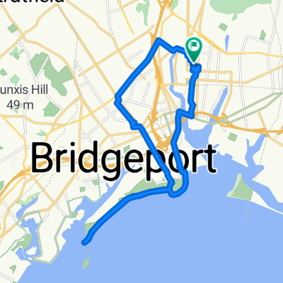
1 Ferry Access Rd, Bridgeport to 8 W Airmount Rd, Mahwah
A cycling route starting in Bridgeport, Connecticut, United States.
Overview
About this route
- 5 h 53 min
- Duration
- 107.3 km
- Distance
- 958 m
- Ascent
- 861 m
- Descent
- 18.2 km/h
- Avg. speed
- 194 m
- Max. altitude
Route quality
Waytypes & surfaces along the route
Waytypes
Quiet road
23.6 km
(22 %)
Road
22.5 km
(21 %)
Surfaces
Paved
32.2 km
(30 %)
Asphalt
24.7 km
(23 %)
Concrete
7.5 km
(7 %)
Undefined
75.1 km
(70 %)
Continue with Bikemap
Use, edit, or download this cycling route
You would like to ride 1 Ferry Access Rd, Bridgeport to 8 W Airmount Rd, Mahwah or customize it for your own trip? Here is what you can do with this Bikemap route:
Free features
- Save this route as favorite or in collections
- Copy & plan your own version of this route
- Split it into stages to create a multi-day tour
- Sync your route with Garmin or Wahoo
Premium features
Free trial for 3 days, or one-time payment. More about Bikemap Premium.
- Navigate this route on iOS & Android
- Export a GPX / KML file of this route
- Create your custom printout (try it for free)
- Download this route for offline navigation
Discover more Premium features.
Get Bikemap PremiumFrom our community
Other popular routes starting in Bridgeport
- Recovered Route
- Distance
- 46.5 km
- Ascent
- 11 m
- Descent
- 32 m
- Location
- Bridgeport, Connecticut, United States
- 1 Ferry Access Rd, Bridgeport to 8 W Airmount Rd, Mahwah
- Distance
- 107.3 km
- Ascent
- 958 m
- Descent
- 861 m
- Location
- Bridgeport, Connecticut, United States
- 906 Kossuth St, Bridgeport to 906 Kossuth St, Bridgeport
- Distance
- 17.6 km
- Ascent
- 7 m
- Descent
- 20 m
- Location
- Bridgeport, Connecticut, United States
- Restful route in Bridgeport
- Distance
- 12.5 km
- Ascent
- 120 m
- Descent
- 129 m
- Location
- Bridgeport, Connecticut, United States
- Greenfield Hill Reservoir Loop
- Distance
- 32.8 km
- Ascent
- 267 m
- Descent
- 269 m
- Location
- Bridgeport, Connecticut, United States
- store
- Distance
- 4.5 km
- Ascent
- 210 m
- Descent
- 202 m
- Location
- Bridgeport, Connecticut, United States
- The Vermont Run
- Distance
- 286 km
- Ascent
- 640 m
- Descent
- 543 m
- Location
- Bridgeport, Connecticut, United States
- Tour of Fairfield. Easy flat training route)
- Distance
- 31.7 km
- Ascent
- 164 m
- Descent
- 166 m
- Location
- Bridgeport, Connecticut, United States
Open it in the app