

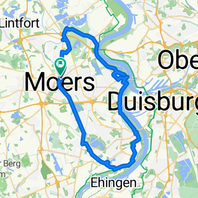
Moränenweg 37, Neukirchen-Vluyn nach Friedrich-Ebert-Straße 134, Duisburg
A cycling route starting in Moers, North Rhine-Westphalia, Germany.
Overview
About this route
- 50 min
- Duration
- 18.4 km
- Distance
- 27 m
- Ascent
- 25 m
- Descent
- 22 km/h
- Avg. speed
- 38 m
- Max. altitude

Route photos


Route quality
Waytypes & surfaces along the route
Waytypes
Quiet road
5 km
(27 %)
Path
4.8 km
(26 %)
Surfaces
Paved
11 km
(60 %)
Unpaved
2 km
(11 %)
Asphalt
9.7 km
(53 %)
Loose gravel
1.3 km
(7 %)
Continue with Bikemap
Use, edit, or download this cycling route
You would like to ride Moränenweg 37, Neukirchen-Vluyn nach Friedrich-Ebert-Straße 134, Duisburg or customize it for your own trip? Here is what you can do with this Bikemap route:
Free features
- Save this route as favorite or in collections
- Copy & plan your own version of this route
- Sync your route with Garmin or Wahoo
Premium features
Free trial for 3 days, or one-time payment. More about Bikemap Premium.
- Navigate this route on iOS & Android
- Export a GPX / KML file of this route
- Create your custom printout (try it for free)
- Download this route for offline navigation
Discover more Premium features.
Get Bikemap PremiumFrom our community
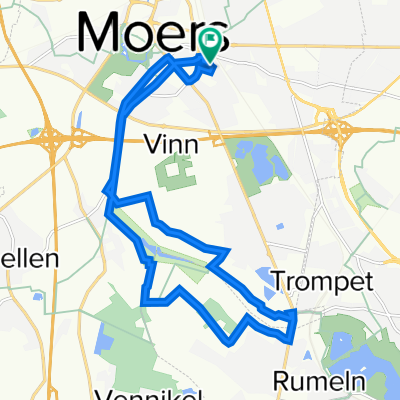
Other popular routes starting in Moers
 Rechts und links des Rheins ab Moers
- Distance
- 72.2 km
- Ascent
- 76 m
- Descent
- 77 m
- Location
- Moers, North Rhine-Westphalia, Germany
 Niederrheinischer Radwandertag Route 15
- Distance
- 43.5 km
- Ascent
- 39 m
- Descent
- 38 m
- Location
- Moers, North Rhine-Westphalia, Germany
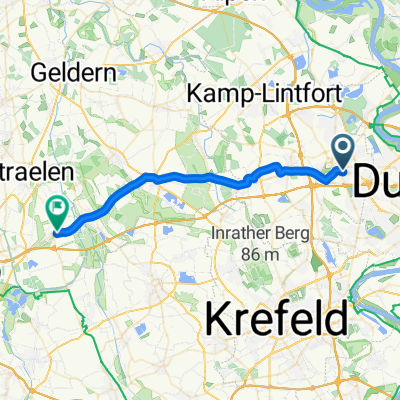
 Rheinberger Straße nach Moers Baerler Straße
- Distance
- 43.9 km
- Ascent
- 105 m
- Descent
- 107 m
- Location
- Moers, North Rhine-Westphalia, Germany
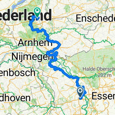
 Oranier-Fahrradroute: Abschnitt Moers - Apeldoorn / Oranjefietsroute: Traject Moers – Apeldoorn
- Distance
- 230.7 km
- Ascent
- 663 m
- Descent
- 671 m
- Location
- Moers, North Rhine-Westphalia, Germany
 Entspannende Route in
- Distance
- 17.6 km
- Ascent
- 16 m
- Descent
- 10 m
- Location
- Moers, North Rhine-Westphalia, Germany
 Wachtendonk - Erkelenz
- Distance
- 27.5 km
- Ascent
- 79 m
- Descent
- 64 m
- Location
- Moers, North Rhine-Westphalia, Germany
 Rundweg Moers-Rheinauen-Töppersee
- Distance
- 40.6 km
- Ascent
- 43 m
- Descent
- 39 m
- Location
- Moers, North Rhine-Westphalia, Germany
 Oranier-Fahrradroute: Abschnitt Moers - Apeldoorn / Oranjefietsroute: Traject Moers – Apeldoorn
- Distance
- 230.7 km
- Ascent
- 665 m
- Descent
- 665 m
- Location
- Moers, North Rhine-Westphalia, Germany
Open it in the app