

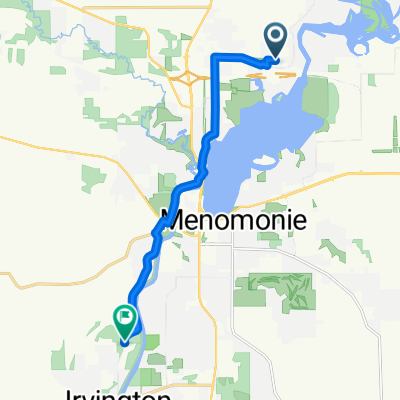
Hudson Road 910, Menomonie to Welsh Drive 2030, Eau Claire
A cycling route starting in Menomonie, Wisconsin, United States.
Overview
About this route
- 59 h 45 min
- Duration
- 219 km
- Distance
- 793 m
- Ascent
- 756 m
- Descent
- 3.7 km/h
- Avg. speed
- 299 m
- Max. altitude

Continue with Bikemap
Use, edit, or download this cycling route
You would like to ride Hudson Road 910, Menomonie to Welsh Drive 2030, Eau Claire or customize it for your own trip? Here is what you can do with this Bikemap route:
Free features
- Save this route as favorite or in collections
- Copy & plan your own version of this route
- Split it into stages to create a multi-day tour
- Sync your route with Garmin or Wahoo
Premium features
Free trial for 3 days, or one-time payment. More about Bikemap Premium.
- Navigate this route on iOS & Android
- Export a GPX / KML file of this route
- Create your custom printout (try it for free)
- Download this route for offline navigation
Discover more Premium features.
Get Bikemap PremiumFrom our community
Other popular routes starting in Menomonie
 60K Sadistic Century
- Distance
- 1.1 km
- Ascent
- 20 m
- Descent
- 17 m
- Location
- Menomonie, Wisconsin, United States
 Menomonie Route 1
- Distance
- 50.1 km
- Ascent
- 326 m
- Descent
- 327 m
- Location
- Menomonie, Wisconsin, United States
 Route in Menomonie
- Distance
- 25.9 km
- Ascent
- 218 m
- Descent
- 220 m
- Location
- Menomonie, Wisconsin, United States
 Devils Punch Bowl
- Distance
- 9.8 km
- Ascent
- 65 m
- Descent
- 68 m
- Location
- Menomonie, Wisconsin, United States
 Moderate route in Menomonie
- Distance
- 5.1 km
- Ascent
- 22 m
- Descent
- 25 m
- Location
- Menomonie, Wisconsin, United States
 2216 Third St W, Menomonie to N4300–N4312 410th St, Menomonie
- Distance
- 13.3 km
- Ascent
- 49 m
- Descent
- 79 m
- Location
- Menomonie, Wisconsin, United States
 Slow Afternoon Course In Menomonie Wisconsin
- Distance
- 12.7 km
- Ascent
- 12 m
- Descent
- 12 m
- Location
- Menomonie, Wisconsin, United States
 Chippewa River Meridean to Red Cedar Trail
- Distance
- 14.8 km
- Ascent
- 24 m
- Descent
- 22 m
- Location
- Menomonie, Wisconsin, United States
Open it in the app