

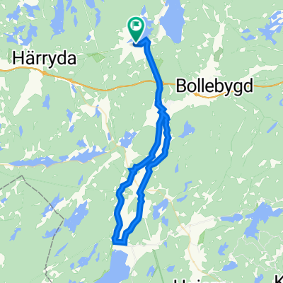
Storåns dalgång aug 2023
A cycling route starting in Hindås, Västra Götaland County, Sweden.
Overview
About this route
- 2 h 13 min
- Duration
- 34.2 km
- Distance
- 254 m
- Ascent
- 253 m
- Descent
- 15.4 km/h
- Avg. speed
- 144 m
- Max. altitude

Route quality
Waytypes & surfaces along the route
Waytypes
Road
21.5 km
(63 %)
Quiet road
11.1 km
(32 %)
Surfaces
Paved
15.2 km
(44 %)
Unpaved
7.3 km
(21 %)
Asphalt
15.2 km
(44 %)
Gravel
6.1 km
(18 %)
Continue with Bikemap
Use, edit, or download this cycling route
You would like to ride Storåns dalgång aug 2023 or customize it for your own trip? Here is what you can do with this Bikemap route:
Free features
- Save this route as favorite or in collections
- Copy & plan your own version of this route
- Sync your route with Garmin or Wahoo
Premium features
Free trial for 3 days, or one-time payment. More about Bikemap Premium.
- Navigate this route on iOS & Android
- Export a GPX / KML file of this route
- Create your custom printout (try it for free)
- Download this route for offline navigation
Discover more Premium features.
Get Bikemap PremiumFrom our community
Other popular routes starting in Hindås
 Hindås-Eskilsbyn-Hällingsjö
- Distance
- 45.3 km
- Ascent
- 415 m
- Descent
- 417 m
- Location
- Hindås, Västra Götaland County, Sweden
 Recovered Route
- Distance
- 35 km
- Ascent
- 291 m
- Descent
- 284 m
- Location
- Hindås, Västra Götaland County, Sweden
 Vägskillnaden 200 to Casemates Square, Gibraltar
- Distance
- 4,038.4 km
- Ascent
- 31,192 m
- Descent
- 31,325 m
- Location
- Hindås, Västra Götaland County, Sweden
 Rävlandarundan
- Distance
- 22.8 km
- Ascent
- 211 m
- Descent
- 206 m
- Location
- Hindås, Västra Götaland County, Sweden
 Grusrunda Hindås
- Distance
- 77.1 km
- Ascent
- 1,348 m
- Descent
- 1,350 m
- Location
- Hindås, Västra Götaland County, Sweden
 Hindås-Rävlanda-Sätila
- Distance
- 45.6 km
- Ascent
- 384 m
- Descent
- 385 m
- Location
- Hindås, Västra Götaland County, Sweden
 Storåns dalgång aug 2023
- Distance
- 34.2 km
- Ascent
- 254 m
- Descent
- 253 m
- Location
- Hindås, Västra Götaland County, Sweden
 57.709° N 12.454° W to 57.710° N 12.481° W
- Distance
- 19.3 km
- Ascent
- 227 m
- Descent
- 201 m
- Location
- Hindås, Västra Götaland County, Sweden
Open it in the app