

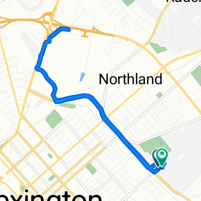
Deer Haven Lane 1970, Lexington to Deer Haven Lane 1945, Lexington
A cycling route starting in Lexington-Fayette, Kentucky, United States of America.
Overview
About this route
- 56 min
- Duration
- 11.3 km
- Distance
- 70 m
- Ascent
- 69 m
- Descent
- 12 km/h
- Avg. speed
- 359 m
- Max. altitude

Continue with Bikemap
Use, edit, or download this cycling route
You would like to ride Deer Haven Lane 1970, Lexington to Deer Haven Lane 1945, Lexington or customize it for your own trip? Here is what you can do with this Bikemap route:
Free features
- Save this route as favorite or in collections
- Copy & plan your own version of this route
- Sync your route with Garmin or Wahoo
Premium features
Free trial for 3 days, or one-time payment. More about Bikemap Premium.
- Navigate this route on iOS & Android
- Export a GPX / KML file of this route
- Create your custom printout (try it for free)
- Download this route for offline navigation
Discover more Premium features.
Get Bikemap PremiumFrom our community
Other popular routes starting in Lexington-Fayette
 811 Oak Hill Dr, Lexington to 814 Oak Hill Dr, Lexington
- Distance
- 8.7 km
- Ascent
- 55 m
- Descent
- 59 m
- Location
- Lexington-Fayette, Kentucky, United States of America
 High-speed route in Lexington
- Distance
- 26.5 km
- Ascent
- 171 m
- Descent
- 171 m
- Location
- Lexington-Fayette, Kentucky, United States of America
 Mark 2 Mark Labor Day Extravaganza!
- Distance
- 46.6 km
- Ascent
- 200 m
- Descent
- 276 m
- Location
- Lexington-Fayette, Kentucky, United States of America
 Deer Haven Lane 1970, Lexington to Deer Haven Lane 1945, Lexington
- Distance
- 11.3 km
- Ascent
- 70 m
- Descent
- 69 m
- Location
- Lexington-Fayette, Kentucky, United States of America
 Legacy trail
- Distance
- 16.9 km
- Ascent
- 63 m
- Descent
- 96 m
- Location
- Lexington-Fayette, Kentucky, United States of America
 50 miler
- Distance
- 81 km
- Ascent
- ---
- Descent
- ---
- Location
- Lexington-Fayette, Kentucky, United States of America
 Bikes & Brews: Lexington Craft Beer Week
- Distance
- 2.1 km
- Ascent
- 22 m
- Descent
- 9 m
- Location
- Lexington-Fayette, Kentucky, United States of America
 1505 Continental Square, Lexington to 1505 Continental Square, Lexington
- Distance
- 17.2 km
- Ascent
- 408 m
- Descent
- 405 m
- Location
- Lexington-Fayette, Kentucky, United States of America
Open it in the app