

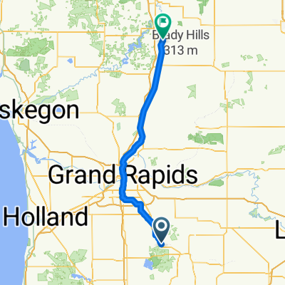
Home trip
A cycling route starting in Middleville, Michigan, United States.
Overview
About this route
- -:--
- Duration
- 1,770.4 km
- Distance
- 5,367 m
- Ascent
- 5,577 m
- Descent
- ---
- Avg. speed
- 622 m
- Max. altitude
Route quality
Waytypes & surfaces along the route
Waytypes
Quiet road
569.3 km
(32 %)
Road
530.9 km
(30 %)
Surfaces
Paved
672.7 km
(38 %)
Unpaved
46.6 km
(3 %)
Asphalt
547.4 km
(31 %)
Paved (undefined)
113.1 km
(6 %)
Continue with Bikemap
Use, edit, or download this cycling route
You would like to ride Home trip or customize it for your own trip? Here is what you can do with this Bikemap route:
Free features
- Save this route as favorite or in collections
- Copy & plan your own version of this route
- Split it into stages to create a multi-day tour
- Sync your route with Garmin or Wahoo
Premium features
Free trial for 3 days, or one-time payment. More about Bikemap Premium.
- Navigate this route on iOS & Android
- Export a GPX / KML file of this route
- Create your custom printout (try it for free)
- Download this route for offline navigation
Discover more Premium features.
Get Bikemap PremiumFrom our community
Other popular routes starting in Middleville
 Middleville - Canadian Lakes
- Distance
- 115.7 km
- Ascent
- 427 m
- Descent
- 356 m
- Location
- Middleville, Michigan, United States
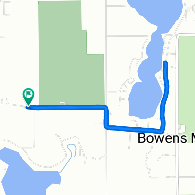 Bowens Mill Road to Bowens Mill Road
- Distance
- 5.4 km
- Ascent
- 64 m
- Descent
- 28 m
- Location
- Middleville, Michigan, United States
 homish
- Distance
- 2,304.7 km
- Ascent
- 15,250 m
- Descent
- 15,461 m
- Location
- Middleville, Michigan, United States
 Home trip
- Distance
- 1,770.4 km
- Ascent
- 5,367 m
- Descent
- 5,577 m
- Location
- Middleville, Michigan, United States
 2726 Foxglove Dr, Middleville to 2726 Foxglove Dr, Middleville
- Distance
- 3.2 km
- Ascent
- 18 m
- Descent
- 16 m
- Location
- Middleville, Michigan, United States
 Route to Paul Henry Thornapple Trail, Middleville
- Distance
- 16.9 km
- Ascent
- 64 m
- Descent
- 64 m
- Location
- Middleville, Michigan, United States
 Bender Road 4785, Middleville to Bender Road 4785, Middleville
- Distance
- 8.3 km
- Ascent
- 4 m
- Descent
- 4 m
- Location
- Middleville, Michigan, United States
 Gun Lake Ride
- Distance
- 68.3 km
- Ascent
- 234 m
- Descent
- 245 m
- Location
- Middleville, Michigan, United States
Open it in the app