

Overview
About this route
Arrau - Bagnères de Luchon
- -:--
- Duration
- 35.4 km
- Distance
- 1,014 m
- Ascent
- 1,115 m
- Descent
- ---
- Avg. speed
- 1,583 m
- Max. altitude

Part of
Pirinei-2023
9 stages
Route quality
Waytypes & surfaces along the route
Waytypes
Road
2.5 km
(7 %)
Quiet road
0.4 km
(1 %)
Surfaces
Paved
26.9 km
(76 %)
Asphalt
26.9 km
(76 %)
Undefined
8.5 km
(24 %)
Route highlights
Points of interest along the route
Point of interest after 19.7 km
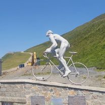
Col de Peyresourde 1569m
Continue with Bikemap
Use, edit, or download this cycling route
You would like to ride Pirinei-04-b or customize it for your own trip? Here is what you can do with this Bikemap route:
Free features
- Save this route as favorite or in collections
- Copy & plan your own version of this route
- Sync your route with Garmin or Wahoo
Premium features
Free trial for 3 days, or one-time payment. More about Bikemap Premium.
- Navigate this route on iOS & Android
- Export a GPX / KML file of this route
- Create your custom printout (try it for free)
- Download this route for offline navigation
Discover more Premium features.
Get Bikemap PremiumFrom our community
Other popular routes starting in Saint-Lary-Soulan
 5 Estarvielle - Llavorsi
- Distance
- 115.7 km
- Ascent
- 2,574 m
- Descent
- 2,724 m
- Location
- Saint-Lary-Soulan, Occitanie, France
 Etapa 1 Pirineos 2013 (144kms)
- Distance
- 144.1 km
- Ascent
- 0 m
- Descent
- 0 m
- Location
- Saint-Lary-Soulan, Occitanie, France
 10.08.07 Col d´Aspin
- Distance
- 42.3 km
- Ascent
- 1,284 m
- Descent
- 1,284 m
- Location
- Saint-Lary-Soulan, Occitanie, France
 11.08.07 Col de Peyresourde
- Distance
- 51.2 km
- Ascent
- 1,051 m
- Descent
- 1,051 m
- Location
- Saint-Lary-Soulan, Occitanie, France
 QV A2M S 4+5 (A)
- Distance
- 207.1 km
- Ascent
- 2,531 m
- Descent
- 2,958 m
- Location
- Saint-Lary-Soulan, Occitanie, France
 Saint Larye - Peyresourde - Superbagneres
- Distance
- 124.7 km
- Ascent
- 3,412 m
- Descent
- 3,412 m
- Location
- Saint-Lary-Soulan, Occitanie, France
 Arreau, Hourquete d'Ancizan, Descenso por Col D'Aspin
- Distance
- 37.7 km
- Ascent
- 1,233 m
- Descent
- 1,233 m
- Location
- Saint-Lary-Soulan, Occitanie, France
 7. Etappe: Arreau - Luz-Saint-Sauveur
- Distance
- 90.1 km
- Ascent
- 3,015 m
- Descent
- 3,009 m
- Location
- Saint-Lary-Soulan, Occitanie, France
Open it in the app