
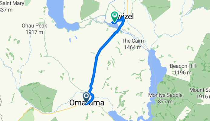
Omarama - Twizel
Cycling route
Overview
About this route
flache, mässig befahrene Route
- -:--
- Duration
- 35.5 km
- Distance
- 133 m
- Ascent
- 98 m
- Descent
- ---
- Avg. speed
- ---
- Max. altitude

Route quality
Waytypes & surfaces along the route
Waytypes
Cycleway
28.7 km
(81 %)
Quiet road
3.2 km
(9 %)
Surfaces
Paved
35.5 km
(100 %)
Paved (undefined)
29.8 km
(84 %)
Asphalt
5.7 km
(16 %)
Continue with Bikemap
Use, edit, or download this cycling route
You would like to ride Omarama - Twizel or customize it for your own trip? Here is what you can do with this Bikemap route:
Free features
- Save this route as favorite or in collections
- Copy & plan your own version of this route
- Sync your route with Garmin or Wahoo
Premium features
Free trial for 3 days, or one-time payment. More about Bikemap Premium.
- Navigate this route on iOS & Android
- Export a GPX / KML file of this route
- Create your custom printout (try it for free)
- Download this route for offline navigation
Discover more Premium features.
Get Bikemap PremiumOpen it in the app