

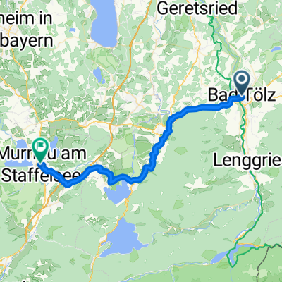
Bad Tölz nach Sylvensteinspeicher/Fall
A cycling route starting in Bad Tölz, Bavaria, Germany.
Overview
About this route
- -:--
- Duration
- 26.2 km
- Distance
- 267 m
- Ascent
- 150 m
- Descent
- ---
- Avg. speed
- 787 m
- Max. altitude

Route quality
Waytypes & surfaces along the route
Waytypes
Cycleway
11.3 km
(43 %)
Path
6.6 km
(25 %)
Surfaces
Paved
12.8 km
(49 %)
Unpaved
12.8 km
(49 %)
Asphalt
12.8 km
(49 %)
Gravel
7.9 km
(30 %)
Continue with Bikemap
Use, edit, or download this cycling route
You would like to ride Bad Tölz nach Sylvensteinspeicher/Fall or customize it for your own trip? Here is what you can do with this Bikemap route:
Free features
- Save this route as favorite or in collections
- Copy & plan your own version of this route
- Sync your route with Garmin or Wahoo
Premium features
Free trial for 3 days, or one-time payment. More about Bikemap Premium.
- Navigate this route on iOS & Android
- Export a GPX / KML file of this route
- Create your custom printout (try it for free)
- Download this route for offline navigation
Discover more Premium features.
Get Bikemap PremiumFrom our community
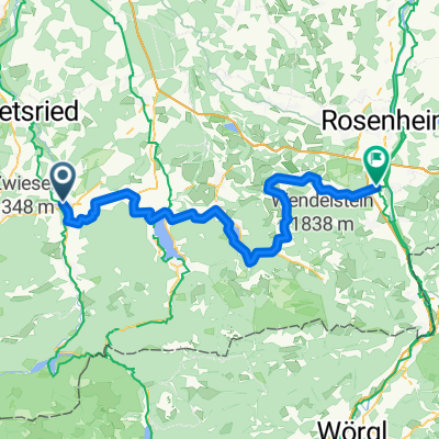
Other popular routes starting in Bad Tölz
 Bad Tölz um Starnberger See und bad tölz nr2
- Distance
- 99.7 km
- Ascent
- 1,047 m
- Descent
- 1,041 m
- Location
- Bad Tölz, Bavaria, Germany
 Runde um Brauneck/Benediktenwand
- Distance
- 75.4 km
- Ascent
- 1,416 m
- Descent
- 1,416 m
- Location
- Bad Tölz, Bavaria, Germany
 Bad Tölz - München
- Distance
- 60.9 km
- Ascent
- 440 m
- Descent
- 574 m
- Location
- Bad Tölz, Bavaria, Germany
 Bad Tölz-Starnberg
- Distance
- 46 km
- Ascent
- 470 m
- Descent
- 521 m
- Location
- Bad Tölz, Bavaria, Germany
 BL: Bad Tölz-Tegernsee-Bad Tölz
- Distance
- 48.2 km
- Ascent
- 363 m
- Descent
- 363 m
- Location
- Bad Tölz, Bavaria, Germany
 Bichl - Murnau am Staffelsee
- Distance
- 40.3 km
- Ascent
- 456 m
- Descent
- 418 m
- Location
- Bad Tölz, Bavaria, Germany
 Radrundtour Tölzer Seenrunde
- Distance
- 82.9 km
- Ascent
- 0 m
- Descent
- 0 m
- Location
- Bad Tölz, Bavaria, Germany
 Von Bad Tölz - Kirchdorf am Inn
- Distance
- 78.3 km
- Ascent
- 1,069 m
- Descent
- 1,272 m
- Location
- Bad Tölz, Bavaria, Germany
Open it in the app