

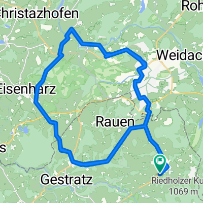
Seltmanns - Weitnau - Buchenberg - Wengen
A cycling route starting in Maierhöfen, Bavaria, Germany.
Overview
About this route
- -:--
- Duration
- 40.3 km
- Distance
- 769 m
- Ascent
- 767 m
- Descent
- ---
- Avg. speed
- 1,051 m
- Max. altitude

Route photos


Route quality
Waytypes & surfaces along the route
Waytypes
Track
12.9 km
(32 %)
Path
10.1 km
(25 %)
Surfaces
Paved
20.5 km
(51 %)
Unpaved
18.9 km
(47 %)
Asphalt
19.3 km
(48 %)
Gravel
14.9 km
(37 %)
Continue with Bikemap
Use, edit, or download this cycling route
You would like to ride Seltmanns - Weitnau - Buchenberg - Wengen or customize it for your own trip? Here is what you can do with this Bikemap route:
Free features
- Save this route as favorite or in collections
- Copy & plan your own version of this route
- Sync your route with Garmin or Wahoo
Premium features
Free trial for 3 days, or one-time payment. More about Bikemap Premium.
- Navigate this route on iOS & Android
- Export a GPX / KML file of this route
- Create your custom printout (try it for free)
- Download this route for offline navigation
Discover more Premium features.
Get Bikemap PremiumFrom our community
Other popular routes starting in Maierhöfen
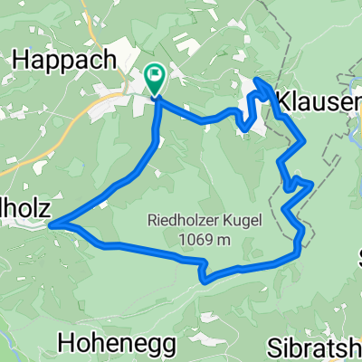 Maierhöfen - Kugel - Riedholz
- Distance
- 9.4 km
- Ascent
- 345 m
- Descent
- 343 m
- Location
- Maierhöfen, Bavaria, Germany
 MTB_2020_Isny01
- Distance
- 53.8 km
- Ascent
- 1,372 m
- Descent
- 1,371 m
- Location
- Maierhöfen, Bavaria, Germany
 2. Etappe Bad Saulgau-Königssee: Riedholz-Füssen
- Distance
- 83.7 km
- Ascent
- 627 m
- Descent
- 572 m
- Location
- Maierhöfen, Bavaria, Germany
 Schweineburg Horben
- Distance
- 18.3 km
- Ascent
- 348 m
- Descent
- 338 m
- Location
- Maierhöfen, Bavaria, Germany
 René Gedenkrunde Sibratshofen
- Distance
- 30.7 km
- Ascent
- 603 m
- Descent
- 604 m
- Location
- Maierhöfen, Bavaria, Germany
 47.637558, 10.073272
- Distance
- 4.5 km
- Ascent
- 302 m
- Descent
- 71 m
- Location
- Maierhöfen, Bavaria, Germany
 Haldenhof über Brugg und Einsenharz
- Distance
- 51.9 km
- Ascent
- 352 m
- Descent
- 352 m
- Location
- Maierhöfen, Bavaria, Germany
 Eistobel
- Distance
- 11.1 km
- Ascent
- 407 m
- Descent
- 408 m
- Location
- Maierhöfen, Bavaria, Germany
Open it in the app